
ALERT: Met Éireann's five day forecast has one major prediction and it's not good!
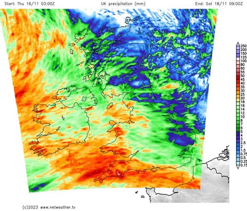

Rain, rain, rain!
Friday: A cold and dry start with some sunny spells. Any lingering frost and mist clearing.
Cloud will build from the southwest later with rain arriving into the southwest before midday. The rain will extend northeastwards through the course of the afternoon, reaching most areas by evening time.
Highest temperatures of 7 to 10 Celsius. Light south to southeast winds will strengthen ahead of the rain increasing strong along coasts.
On Friday night, after a wet and blustery start, the rain will clear northeastwards through the night with clear spells and squally showers following from the west as fresh to strong southeast winds veer south to southwest by morning moderating a bit. Lowest temperatures early in the night of 4 to 8 degrees, rising overnight to be in double figures by morning.
Saturday: A breezy day Saturday with widespread heavy or thundery showers, merging to longer spells of rain at times. Highest afternoon temperatures of 12 to 14 degrees in fresh southwest winds, stronger near coasts.
On Saturday night showers will continue into the night with longer spells of rain in parts too. Lowest temperatures of 8 to 10 degrees in brisk southwest winds, very strong near some coasts.
Sunday: Further showers or spells of showery rain are expected on Sunday. Moderate to fresh southwesterly winds at first, veering westerly through the afternoon with some brighter spells coming through. Highest temperatures of 10 to 12 degrees generally.
Monday: Further rain or showers on Sunday night and Monday and a little cooler by then as the winds turn to the northwest, very strong and gusty in parts and especially near coasts.
Tuesday: Current indications suggest drier conditions for Tuesday and Wednesday as the winds ease.