
ALERT: Met Éireann's five-day Irish weather forecast is in for the coming week
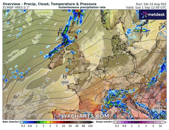

The Irish weather for the next few days will be...wet and windy!
Sunday: A wet and blustery start on Sunday with outbreaks of rain, heavy at times, especially in Connacht and Ulster with the potential for spot flooding.
By afternoon, the rain will turn patchy across Munster and south Leinster with some bright or sunny intervals likely to develop.
Staying cloudy and damp across Connacht, Ulster and much of north Leinster with rain and drizzle at times. Highest temperatures of 14 to 18 degrees in fresh to strong southwesterly winds.
National Outlook
Overview: Continuing unsettled with rain or showers at times. Temperatures improving in the early days of next week becoming closer to average for the time of year.
Sunday night: Becoming mainly dry with some clear spells as rain becomes lighter and patchier before mostly dying out. There will be a few light showers. Lowest temperatures of 10 to 13 degrees with light to moderate southwest breezes.
Monday: It will start out mainly dry on Monday with bright or sunny spells and just light patchy rain. In the afternoon, persistent rain will develop in the west and will spread eastwards across the country through the evening. Highest temperatures of 16 to 19 degrees with mostly moderate southerly winds.
Monday night: A wet and windy night as rain becomes widespread. The rain will be heaviest in parts of the west and southwest early on in the night. Lowest temperatures of 14 to 16 degrees in a fresh southerly wind strong and gusty on western and northwestern coasts
Tuesday: A wet start especially over the eastern half of the country as overnight rain will clear eastwards through the morning with showers following the clearance in the west. It will then be a largely dry day for many away from the west and northwest with scattered showers there. Highest temperatures of 17 to 21 degrees, in a light northerly breeze
Tuesday night: Outbreaks of showery rain will slowly move into Atlantic counties Tuesday night while elsewhere it will remain mainly dry with clear spells. Lowest temperatures of 10 to 13 degrees in light to moderate breezes.
Wednesday: Current indications suggest showers and longer spells of rain will slowly spread eastwards on Wednesday. Highest temperatures of 17 to 20 degrees, in a light to moderate southerly wind.
Overview: The rest of next week will continue unsettled with rain or showers at times.