
ALERT: Met Éireann's Irish weather forecast for the week ahead after Storm Ashley
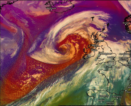

Met Éireann's Irish weather forecast for the coming week has landed...
MONDAY: Monday will be a drier, brighter day with spells of sunshine and scattered showers. Turning cloudier from the west in the afternoon and evening with showery outbreaks of rain spreading eastwards. Highest temperatures of 12 to 15 degrees in moderate to fresh southwest winds, strong on Atlantic coasts.
SUMMARY: There'll with a good lot of dry weather in many areas for the next couple of days, before becoming more unsettled later in the week, then while there's some uncertainty, there's the likelihood of some drier weather for the Bank Holiday weekend.
Monday night will be rather cloudy for a time with showery outbreaks of rain continuing to spread eastwards, followed by some clear spells and a few showers into western parts. Lows of 6 to 10 degrees with winds decreasing light to moderate southerly.
TUESDAY: There'll be a few showers or a little rain for a time early on Tuesday, but it'll become mostly dry and bright with good spells of sunshine. Highs of 13 to 15 or 16 degrees in light to moderate southwesterly winds.
Tuesday night with be generally dry for a time with clear spells, however it'll become increasingly cloudy from the west with a little rain and drizzle moving in from the west, mainly affecting western and southern parts, with some hill and coastal mist too. Lows of 7 to 11 degrees in mostly light to moderate southerly winds, freshening a little in western and northwestern coastal parts.
WEDNESDAY: Wednesday will bring a good deal of dry weather to many areas and while it'll be rather cloudy overall, some bright or sunny spells will develop, mainly across the midlands and east. It'll stay rather cloudy in western and southern coastal parts though, with a little patchy light rain and drizzle at times, mainly further south. Highest temperatures of 14 to 16 or 17 degrees in freshening southerly winds.
It'll be rather blustery on Wednesday night with fresh to strong and gusty southerly winds. It'll be cloudy with just scattered outbreaks of light rain and drizzle in western and southern coastal parts at first. However, a band of heavier and more persistent rain will start to move in from the west. Lowest temperatures of 10 to 12 degrees.
THURSDAY: Rain will gradually spread from the west on Thursday and some of it will be heavy, with some spot flooding. While timing is uncertain, a clearance will start to extend from the from the west later on. Highest temperatures of 12 to 16 degrees in fresh to strong and gusty southerly winds, veering southwesterly and easing.
Any remaining rain will clear eastwards on Thursday night with showers following, some heavy and possibly thundery. Turning cooler as the rain clears with lowest temperatures of 4 to 8 degrees. Light to moderate southwest winds, will veer west to northwest overnight and increase fresh to strong and gusty, especially in western areas.
FRIDAY: Friday will be breezy with sunshine and showers, some heavy and some possibly thundery, especially in the west. A cooler day on Friday with highest temperatures of 9 to 12 degree in blustery northwest winds, easing later.
The showers will tend to become isolated and mainly confined to western coastal parts on Friday night, with long clear spells developing. Lowest temperatures of 3 to 8 degrees with winds gradually decreasing light to moderate westerly.
BANK HOLIDAY WEEKEND: With high pressure closeby it looks like there'll be a lot of dry weather overall. However there's still some uncertainty at this lead time and there's still a chance of some rain moving in from the northwest, though amounts should be small.