
How much snow is on the way to Ireland? The latest forecastMet Éireann on the #sneactha

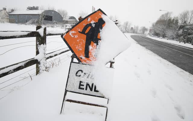

Met Éireann has warned of snow and ice in parts of Ireland in the coming days with falls of rain, sleet and snow on the cards.
Warnings have been issued but the forecaster for the early part of the week but it has yet to make a detailed prediction on what will happen this weekend when its forecasting partner in the UK is warning of significant snow.
The forecaster has issued Status Yellow a low temperature/ice warning for Cavan, Donegal, Monaghan, Connacht, Longford, Louth, Meath, Westmeath for Tuesday night.
The alert says hazardous conditions due to freezing temperatures. Icy stretches on roads and footpaths.
It is valid from 9pm Tuesday to 9am Wednesday.
The forecaster has also issued a Status Yellow snow/ice warning for Cork and Kerry.
It warns of patchy sleet or snow overnight and Wednesday morning with the potential for hazardous conditions on some roads and footpaths.
It is valid from midnight Tuesday to noon on Wednesday.
A Status Yellow snow / ice warning has also been issued for Cavan, Donegal, Monaghan, Connacht, Longford, Louth, Meath, Westmeath.
It says a spell of rain will move up over the country on Thursday morning, turning to sleet and snow with some accumulations expected. Met Éireann warns that this could cause hazardous driving conditions and disrupt travel.
This alert is valid from 6am Thursday to midnight on Friday.
In its national forecast, Met Éireann says it cold through the rest of the working week, especially in the north, with falls of rain, sleet and snow. MORE BELOW TWEET.
A forecasting commentary says there are uncertainties surrounding the forecast for Thursday, March 9. However, it says precipitation will almost certain to fall as rain in milder air to the south of the country with sleet through north Munster and into the midlands and a "very high likelihood of snow in north Leinster and Ulster".
According to Dr Alan Hally, Forecasting Services Manager at Met Éireann: “Our high-resolution ensemble prediction system is specifically designed to represent the uncertainties related to these types of events. In Ireland, the occurrence of snow is almost always a marginal event, and our forecasters rely heavily on ensemble prediction systems in order to determine the most likely outcome and to decide on appropriate and timely warnings”.
National Forecast issued on March 7 at 12.59pm below tweet
Tuesday: A mostly sunny afternoon, but cloud will increase again in the southwest. Many places dry, although a few scattered showers, some wintry in nature, will continue to affect parts of the north and northwest. Top temperatures of 3 to 6 degrees with light to moderate northerly winds veering easterly this afternoon and freshening in the southwest.
Cold and frosty night. Dry for most with cloud in the south gradually building up over Munster and south Leinster with a few patches of rain, sleet and snow moving into the far southwest. Lowest temperatures of -4 to 0 degrees, falling as low as -5 or -6 degrees in Ulster and the northwest. Light to moderate northeast to east winds, fresher in the southwest.
Wednesday: Another cold and frosty start to the day, especially in the north, with some icy stretches in places. Largely cloudy over the southern half of the country with patchy rain, sleet and snow at times in southern areas. Dry and sunny further north. Highest temperatures again of just 3 to 6 degrees in light to moderate easterly winds, continuing fresher in the southwest.
Rain, sleet and snow from the southwest will become countrywide with parts of Ulster will staying dry. Lowest temperatures of minus 2 to plus 2 degrees, colder over Ulster with temperatures there as low as minus 4 degrees. Moderate to fresh easterly winds.
Thursday: Rain sleet and snow with accumulations possible over the northern half of the country. Temperatures struggling to get above freezing in the north, it'll be milder further south, with temperatures there of 6 to 10 degrees. Moderate to fresh easterly winds will back northeasterly later.
Sleet and snow will become confined to the north and east later in the night with largely dry conditions developing elsewhere. Lowest temperatures of minus 2 to plus 1 degrees generally, colder in the northwest, with northerly winds easing light to moderate.
Friday: Rain, sleet and snow in the south at times with mainly dry weather elsewhere with just isolated showers. Highest temperatures of 2 to 6 degrees in mostly light northeasterly winds. Becoming mostly dry for the evening.
Mostly dry to start the night before rain, sleet and snow extends over much of the country. Lowest temperatures of minus 3 to plus 1 degrees generally, colder in the north where it will be driest.
Saturday: A wet day with widespread outbreaks of sleet and snow gradually transitioning to rain as temperatures increase through the afternoon, reaching 6 or 7 degrees in the north in the late afternoon and 12 or 13 degrees in the south.
Further Outlook: Unsettled with spells of rain and showers, heavy at times. Breezy at times too. Temperatures increasing through the rest of the weekend and early next week.