
Laois rivers near flood level as Status Yellow Rain weather warning continues


Rivers in Laois are rising again this Monday evening, October 23 as the county remains under a deluge of rain and a Met Éireann Status Yellow Rainfall warning.
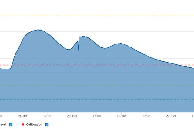

A gauge at The Borness, Mountmellick, a rural flood zone, appears to have stopped working on October 19.
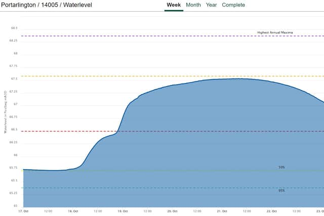
The statistics are updated hourly on the new OPW website waterlevel.ie, available to view here.
There is a Status Yellow - Rain warning in place for Carlow, Dublin, Kildare, Laois, Longford, Louth, Meath, Offaly, Westmeath, Wicklow, Roscommon until 1am on Tuesday, October 24.
it is for rain, heavy at times with the chance of thunder. Possible impacts are localised flooding and difficult travel conditions.
A Status Orange - Rain warning is also in place, for Kilkenny, Wexford, Waterford until 1am.
In the forecast for this week, there is some relief from the rain on Tuesday, but it will return.
On Tuesday is a mix of cloud and isolated showers but some dry spells at times too. The showers will largely die out and it will become mostly dry with sunny spells in the afternoon. Highest temperatures of 12 to 14 degrees and mostly light winds.
Wednesday: Cloudy early on with outbreaks of rain across Munster. The rain will gradually spread northeast across the country later in the morning and afternoon. Some heavy and thundery falls are possible with spot flooding also. Highest temperatures of 10 to 13 degrees and blustery winds.
Wednesday Night: Overcast with widespread rain, heavy at times too. The rain will gradually move away to the north followed by scattered showers overnight. Lowest temperatures of 5 to 8 degrees and blustery westerly winds.
Thursday: Rather cloudy with scattered showers, some heavy in the west. Highest temperatures of 11 to 14 degrees and a fresh to moderate southwesterly breeze.
Friday: Current indications are that the unsettled weather will continue through Friday with showers forecast for most counties, some possibly heavy at times too. Temperatures are likely to reach the low teens.