
Met Éireann flags snow and ice in severe cold snap #sneachta

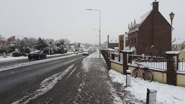

Met Éireann has put people on alert for snow, severe frost and icy stretches as wintry weather is set to grip Ireland.
The forecaster has also issued a Winter Weather Advisory for Ireland for a week as an Arctic airmass sets in. The advisory says this will bringing sharp to severe frosts and icy stretches on roads.
"Showers of hail, sleet, and snow will occur during the second half of the week," it says.
The Advisory, which will be updated during the week is valid from Sunday, December 4 to Saturday, December 10. While no warnings are in place the forecaster says it will be providing updates.
In a weather commentary, Met Éireann Meteorologist Matthew Martin outlined more.
“After such a mild November, the upcoming cold spell will be a shock to the system for many," he said.
He said the much colder northeasterly air-flow is forecast to become established over Ireland by Wednesday.
"Whilst there remains some uncertainty in forecast detail, there is growing confidence that it will turn very cold from Wednesday and through the latter days of next week. Wintry showers of hail, sleet and snow are expected at times along with the possibility for severe frost and ice. Daytime temperatures are forecast to be in the low single figures with sub-zero temperatures by night," he said.
People are advised that air temperatures will decrease with the mean temperature by the end of the week expected to be as 4 degrees below the seasonal average. FULL DETAILS BELOW TWEET.
Met Éireann National Forecast issued at 4.09pm on December 4
Monday: Mainly dry conditions to the north and northwest with sunny spells. Somewhat cloudier elsewhere with some scattered showers. Highest temperatures of 4 to 8 degrees in mainly light or moderate northeasterly breezes, fresher near western and southwestern coasts.
Monday night will see some scattered showers continuing near the east and south coast but it will be mostly dry elsewhere with clear spells. Lowest temperatures of -2 to 3 degrees, coldest in the north with a widespread frost setting in, in light or moderate northeasterly breezes.
Tuesday: Dry in most areas with good sunny spells in many areas. Just a few isolated showers especially near the east coast where it may be somewhat cloudier. Highest temperatures of 4 to 7 degrees in light north to northeast breezes.
Very cold on Tuesday night with light northerly breezes and largely clear skies. Isolated showers may continue near the north and northwest coast. Widespread frost is expected as temperatures fall to between 0 and minus 4 degrees.
WEDNESDAY: Good sunny spells on Wednesday, though it will remain chilly with afternoon temperatures reaching just 2 to 6 degrees. Dry for most areas. However, scattered showers will affect northern and northwestern coastal areas and these will edge further inland over Ulster and Connacht during the evening and night, turning increasingly wintry with falls of snow likely, especially on higher ground. Light north to northwesterly breezes. Bitterly cold overnight with temperatures below freezing countrywide leading to a widespread sharp to severe frost and icy stretches.
THURSDAY: Thursday looks like a very cold day countrywide with sunny spells and scattered wintry showers of hail, sleet and snow in places. Temperatures in the low single figures in a light northerly breeze.
Current indications are that it will stay very cold through the remainder of the week and for next weekend too.