
Status Red Storm Amy to batter Ireland with 'violent' winds warns Met Éireann

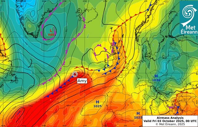

Met Éireann has Status Red, Orange and Yellow alerts in place and urges people to stay safe
Storm Amy is battering Ireland with Status Red weather conditions impacting seas just of the west coast while the rest of the country is under Met Éireann Status Orange or Yellow Met weather alerts.
Morning reports Met Éireann observation stations on Friday before the full impact of the storm was being felt showed winds hitting 65 kms along the west coast with gusts of up to 40 kms inland.
The latest Met Éireann forecast warned that Storm Amy would bring heavy rain and very windy or stormy conditions on Friday with strong to gale force south to southwest winds, veer westerly, along with severe and damaging gusts.
It warned that winds would increase to storm or "violent storm force" in western and northwestern coastal areas at times during the afternoon and evening. Rain from the southwest was due to extend across the country, heavy spells at times, possibly causing spot flooding.
The rain is expected to gradually clear eastwards through the afternoon, followed by scattered showers and some brighter breaks. Highest temperatures of 16 to 19 degrees.
Friday night is also expected to be windy with widespread heavy showers or longer spells of rain. Strong to near gale force west to southwest winds will affect the country with gales on northern and western coasts. Cooler with lowest temperatures of 6 to 9 degrees.
WATCH LIVE: Storm tracker here
Saturday will also be wet and windy with strong and gusty westerly winds. A band of heavy showery rain will move down from the north across the country. The afternoon will gradually become drier with just well scattered showers and some sunny spells developing at times too. Cooler with highest temperatures of 12 to 15 degrees.
The forcaster has issued a Status Red marine area storm warning from Loop Head to Rossan Point to Fair Head along the west coast.
This will feature southwest to west winds reaching violent storm force 11 at times. Storm force winds can reach nearly 120 kms an hour.
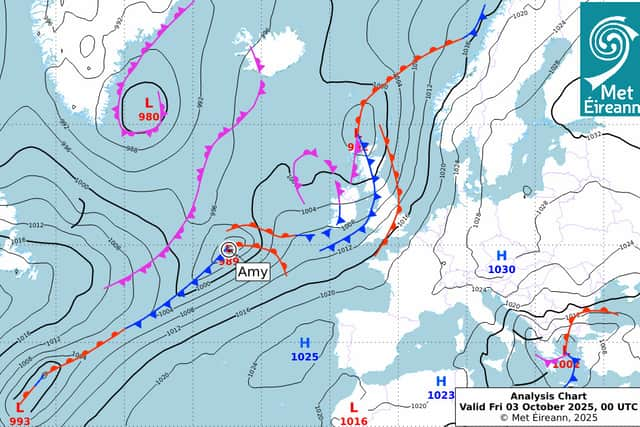
Status Orange - Wind warning for Clare, Donegal, Galway, Leitrim, Mayo, Sligo
Near gale force to gale force and very gusty southwest to west winds.
Impacts: • Fallen trees; • Damage to power lines and possible power outages; • Very difficult travelling conditions; • Possible wave overtopping
Valid: 14:00 Friday 03/10/2025 to 22:00 Friday 03/10/2025
Status: Yellow Rain warning for Galway, Kerry
Potential impacts: • Flooding; • Difficult travelling conditions;
Valid: 09:00 Friday 03/10/2025 to 15:00 Friday 03/10/2025
Status: Yellow
Storm Amy: Strong to near gale force and gusty southwesterly winds. Met Éireann Weather Warning
Potential impacts: • Difficult travelling conditions; • Debris, loose objects displaced; • Some fallen trees possible
Valid: 12:00 Friday 03/10/2025 to 00:00 Saturday 04/10/2025