
Status Red Storm Éowyn hitting nearly 100 kmph with worse to follow

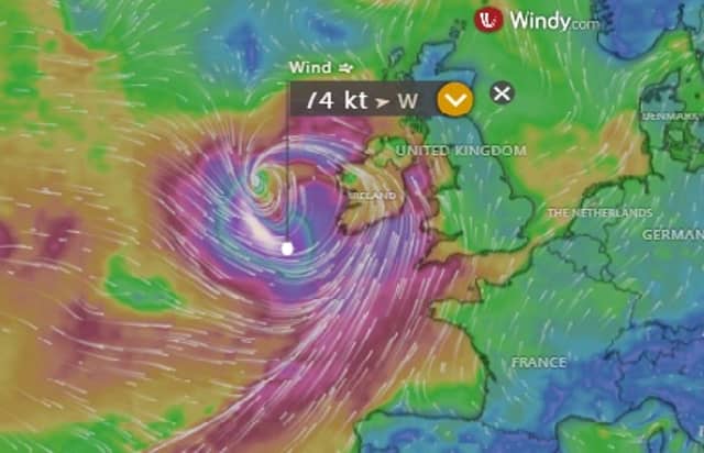

Met Éireann has issued multiple red alerts
Met Éireann Storm Éowyn weather stations show 100 kmph winds offshore with the storm already causing near 100 kmph gusts as it nears Ireland.
The weather forecaster's weather stations and bouys are confirming the expected strength of the storm as it barrels into Ireland.
Buoys off the south coast show that the wind gusts are exceeding or have hit or exceeded 100 kmph in high seas of the west and Cork coasts.
Latest reports from Met Éireann weather stations show gusts of over 90 kmph at Valentia Island in Co Kerry at 9pm.
Windy.com shows winds of nearly 140 kmph near the centre of the storm in the Atlantic.
Met Éireann forecast issued at 9.30pm on Wednesday said that Storm Eowyn would bring severe or extreme southeasterly to southwesterly winds overnight, with destructive and damaging gusts.
It said violent storm-force winds will occur near the southwest and west coasts.
It warned that the impacts would be severe with power outages and significant disruption due to falling trees and structural damage. A spell of heavy rain will continue to track northeastwards across the country with localised flooding, especially for southern counties.
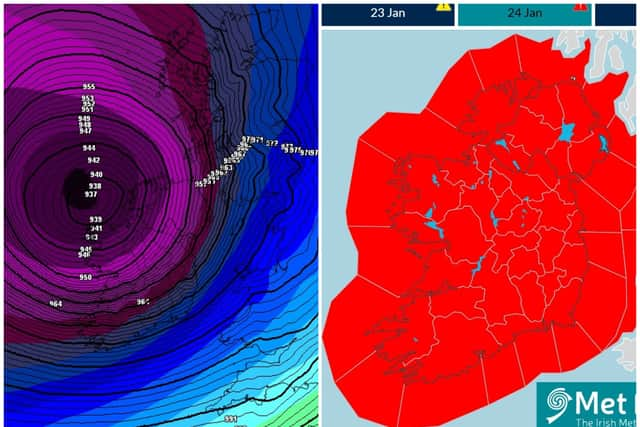
Met Éireann warned that Storm Eowyn would continue to bring severe or extreme southwest to west winds, with destructive and damaging gusts. The forecaster said violent storm force winds would occur for a time near west and northwest coasts. He said impacts woull be severe with power outages and significant disruption due to falling trees and structural damage.
The forecaster said scattered squally showers with longer spells of rain across the north of the country. Highest afternoon temperatures of 5 to 8 degrees but feeling much colder due to wind-chill. The winds will ease from the south through the afternoon and evening.
The outlook is for winds to continue to ease and will become light to moderate Friday night. A cold night with clear spells and scattered showers, some of sleet and snow. Lowest temperatures of zero to plus 2 degrees with some frost possible towards dawn on Saturday.