
Storm Isha - Met Éireann issues Status Red, Orange, Yellow warnings for violent storm

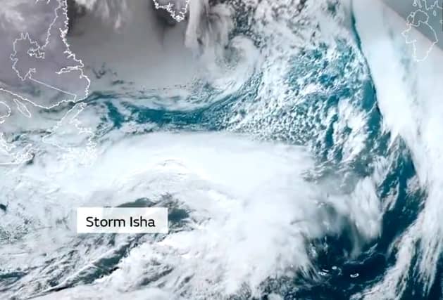

Met Éireann weather issues alerts as winds 100km h to hit
Storm Isha has caused Met Éireann to issue all levels of weather warnings with the violent classified storm expected to batter Ireland with damaging winds and heavy rain.
The forecaster says Storm Isha will bring wet and very windy weather on Sunday night into Monday morning. The event, which was named by Met Éireann's storm forecasting partner the UK Met Office, has caused Met Éireann to issue status Red, Orange and Yellow Alerts as follows.
A national Status Yellow wind warning advises of strong and gusty southwest winds with heavy rain at times from 11 am Sunday to 4 am Monday
Met Éireann says the potential impacts are:
- Large coastal waves with wave overtopping
- Difficult travelling conditions
- Debris, loose objects displaced
Status Orange wind warnings have been issued for all counties.
The Orange alert for Leinster, Cavan, Monaghan, Munster, Connacht warns that Storm Isha will bring very strong southwest winds with severe and damaging gusts with impacts:
- Large coastal waves with wave overtopping
- Very difficult travelling conditions
- Fallen trees
- Damage to power lines
This alert is valid from 5 pm on Sunday to 2 am on Monday.
Donegal looks set to be in most danger from Storm Isha with Met Éireann placing the county under a longer Status Orange alert from 5 pm on Sunday to 5 am on Monday.
The county's coastline looks set to be at the highest risk which has caused Met Éireann to issue a Status Red marine area storm warning from Erris Head to Bloody Foreland to Fair Head.
It says southwest to west winds will reach storm force 10 or violent storm force 11. Such winds are associated with a violent storm on the Beaufort Scale with speeds reaching 103–117 km/h.
The Status Red marine warning is valid from 7pm Sunday to 1am on Monday.
Storm Isha has issued other Status Orange and Yellow marine area warnings for sea areas on all coasts around Ireland. More below tweet.
Forecast from Met Éireann below link
Sunday: It will become very windy during Sunday as Storm Isha tracks to the northwest of Ireland. Very strong and gusty southwesterly winds will develop countrywide, with strong gales and high waves along coasts. It will be a wet day too, with rain becoming heavy or thundery at times, particularly in the west and south. Highest temperatures of 10 to 13 degrees.
It will be wet and very windy early on Sunday night with very strong and gusty southwest to west winds and strong gales near coasts. Winds will become westerly and decrease in most areas overnight, but will stay very strong in the northwest, and there'll be clear spells and scattered showers. Lowest temperatures of 3 to 7 degrees.
Monday: Breezy and blustery with sunny spells and scattered showers, some heavy with a chance of hail. Highest temperatures of 6 to 9 degrees with a fresh and gusty westerly wind.
Monday night will start off mostly dry with just a few showers in the north and northwest. Rain and drizzle will develop in the southwest and west and will spread to most areas overnight. Lowest temperatures of 3 to 7 degrees with a moderate to fresh southerly wind developing. More below tweet.
Tuesday: Tuesday will be wet and windy with heavy rain at times, along with fresh to strong southwesterly winds. The rain will clear to scattered showers later in the day, most of these occurring in the northwest. Mild with highest temperatures of 10 to 14 degrees.
Windy early in the night with fresh to strong and gusty southwest to west winds, decreasing moderate to fresh overnight. Clear spells and scattered showers, mainly in the north and west. Lowest temperatures of 5 to 8 degrees.
Wednesday: Most areas will be dry with sunny spells on Wednesday, although a few showers are possible in the north. Winds will become lighter and temperatures will reach 9 or 10 degrees.
Further outlook: Turning unsettled again with more wet and breezy weather expected.