
Rest in Peace Anne and John Byrne
Search
23 Jan 2026
Please allow ads as they help fund our trusted local news content.
Kindly add us to your ad blocker whitelist.
If you want further access to Ireland's best local journalism, consider contributing and/or subscribing to our free daily Newsletter .
Support our mission and join our community now.
To continue reading this article, you can subscribe for as little as €0.50 per week which will also give you access to all of our premium content and archived articles!
Alternatively, you can pay €0.50 per article, capped at €1 per day.
Thank you for supporting Ireland's best local journalism!


7:27am - Contact has been made to our socials that there is no power on Arranmore, Inver, Raphoe and Ballintra
7:22am - Gardí confirm 'serious road traffic collision' on the N14, north of Lifford
7:15am - 1,744 Customers are affected by outages in Bundoran; 1279 in Donegal Town and 2154 at Drumbar.
7:06am - An Grianán Theatre in Letterkenny last night posted: "Due to the Red Weather Warning in place for Donegal, we will remain closed on Friday until 5.30 pm when we will reopen. The Wizard of Oz showing at 7.30pm will go ahead as planned but we will be monitoring the situation closely an make any updates if anything changes."
7:03am - 1,062 Customers are affected by a power outage in Ballyshannon. Derrybeg is still out with 816 impacted.
7am - If travel is a must, McGinley Coach Hire posted of today's Donegal to Dublin services:
"Due to the Red weather warning in effect, we regret to inform you that all services on the Donegal to Dublin route will be cancelled during the earlier part of the day. The revised services will be as follows: First service from Letterkenny to Dublin: 14:45; First service from Moville to Dublin: 15:30; First service from Dublin to Donegal: 15:30
The safety of our passengers and staff is our top priority, and we appreciate your understanding during this time.
If you have a reservation on any affected service tomorrow, you will receive an email from us shortly with details of your options. For flexibility, you can also amend your booking directly on our website by selecting "Amena My Booking."
6:55am - Donegal County Council advise the public that road conditions throughout the county are treacherous this morning with fallen trees on numerous routes. Advice is to remain in place and not to travel until this storm has passed and it is safe to do so.
6:54am - The highest gust record of 182 km/h set in 1945 at Foynes Co Limerick has provisionally been broken
6:52am - N14 Lifford to Letterkenny Road is impassable at Feddyglass (Ballinalecky to Whitecross) due to trees down. Motorists should seek alternative routes for essential travel. Diversions from Ballinalecky crossroads.
6:45am - Storm Éowyn is predicted to be the worst in Ireland since Storm Debbie caused havoc in 1961, saw 18 people lose their lives when the joint-highest ever national wind reading was recorded in Donegal. Please click on the link below for a lookback, written in November 2023.
READ NEXT: When Donegal was hit by Hurricane Debbie - Ireland's worst storm in living memory
6:41am - An Garda Siochana here in Donegal have shared contact numbers for those in need.
"Please stay safe," they said. "Remain indoors and do not travel for the duration of the red warning. The following Garda Stations are open on a 24/7 basis: Letterkenny 074-9167100; Milford 074-9153060; Buncrana 074-9320540; Ballyshannon 071-9858530. Call 999 or 112 in the event of an emergency."
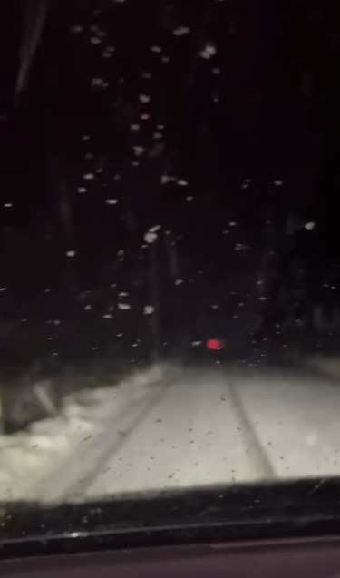
6:40am - Pat the Cope Gallagher TD posted snowfall late last night - Snowing on the Donegal -Frosses - Kilraine Road
"Take Care," he added.
6:35am - Séimi Ó Dubhthaigh, Donegal Heritage posted: "Update at 5.00hrs from Carrickfinn Observation Post. Lowest barometric recording here ever- 27in. My humble static abode is riding the storm well, Mama Cat is curled up underneath the heater."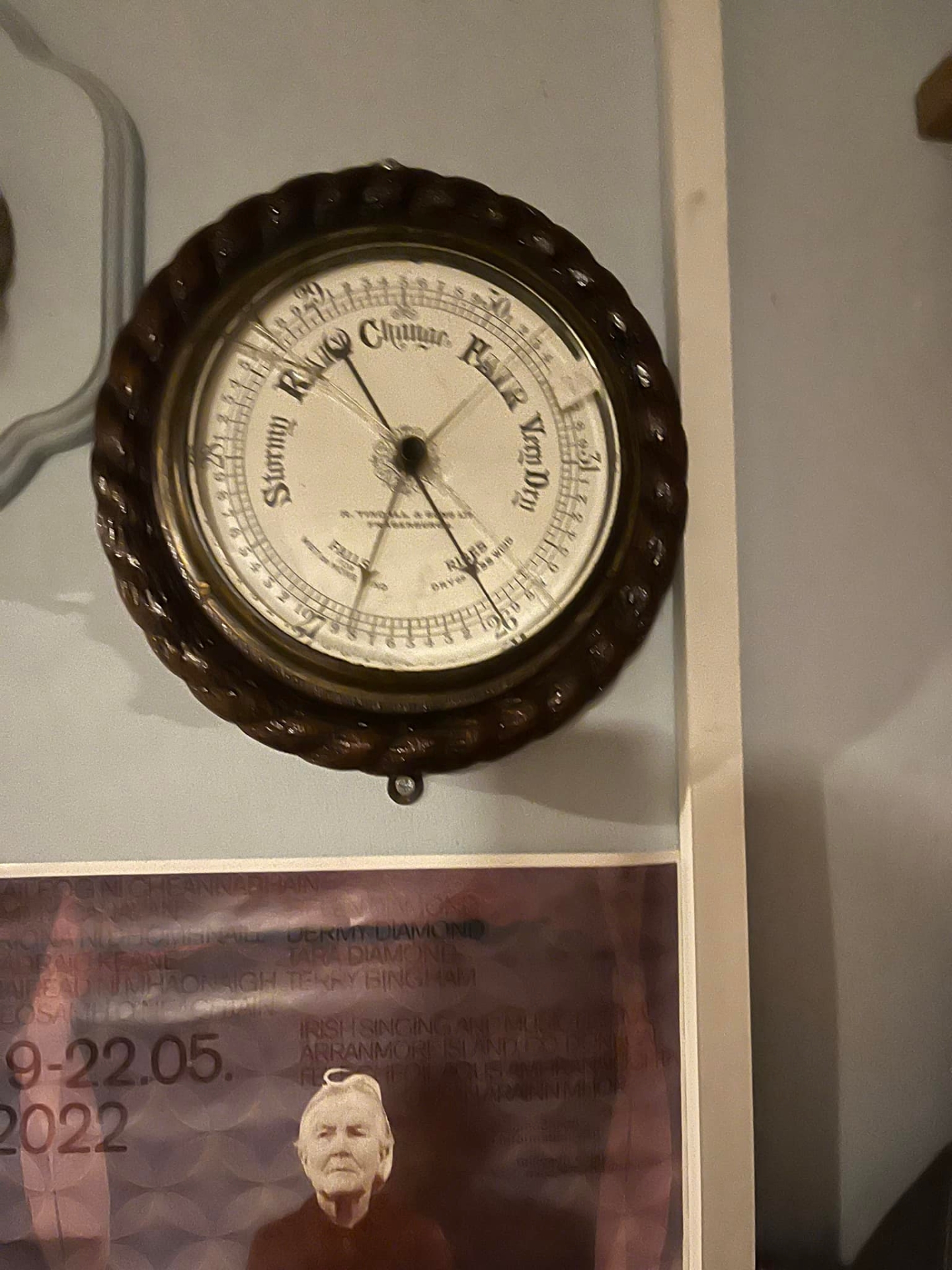
A barometer is a device that reads atmospheric pressure. It uses liquid mercury to predict the weather by tracking atmospheric pressure changes resulting from the movement of warm and cold weather systems. A barometric reading in the range of 29.80 and 30.20 inHg can be considered normal, and normal pressure is associated with steady weather, 27 shows extremely low pressure. Rapidly falling pressure indicates a storm is coming. "This one seen many’s the gale since 1906," Séimi posted.
6:32am - Nationally, Storm Éowyn damage impacts 560,000 homes, farms and businesses: ESB Networks teams will commence restoring power where safe to do so, according to ESB. "There has been unprecedented, widespread and extensive damage to electricity infrastructure so far with power outages nationwide affecting 560,000 customers as of 6:00am," they said. "We anticipate significant further outages as Storm Éowyn moves across the country."
6:30am - Here is a tracker which shows the exact time Storm Éowyn will hit Donegal in weather latest
6:25am - There are currently power outages in Convoy (1,541 customers affected), Dungloe (1,677), Derrybeg (816) and Killybegs/Dunkineely (831). ESB Networks says the estimated restore time for all is "currently unknown."
6:15am - On Wednesday it was learned that Donegal was headed for a status red weather warning on Friday with Storm Éowyn on the way, Met Éireann have said.
The Extreme Weather Warning for Wind for Donegal is in place from Friday at 6am till Friday at 3pm.
"Gale to storm force southerly winds becoming westerly will bring severe, damaging and extremely destructive gusts in excess of 130km/h," Met Éireann said.
"Impacts include danger to life, extremely dangerous travelling conditions, unsafe working conditions, disruption and cancellations to transport, many fallen trees, significant and widespread power outages, impacts to communications networks, cancellation of events, structural damage, wave overtopping and coastal flooding in low-lying and exposed areas."

Subscribe or register today to discover more from DonegalLive.ie
Buy the e-paper of the Donegal Democrat, Donegal People's Press, Donegal Post and Inish Times here for instant access to Donegal's premier news titles.
Keep up with the latest news from Donegal with our daily newsletter featuring the most important stories of the day delivered to your inbox every evening at 5pm.
This publication supports the work of the Press Council of Ireland and Office of the Press Ombudsman, and our staff operate within the Code of Practice of the Press Council. You can obtain a copy of the Code, or contact the Council, at www.presscouncil.ie, Lo-call 1800 208 080 or email: info@presscouncil.ie.


