Search
11 Nov 2025
Search
11 Nov 2025
Please allow ads as they help fund our trusted local news content.
Kindly add us to your ad blocker whitelist.
If you want further access to Ireland's best local journalism, consider contributing and/or subscribing to our free daily Newsletter .
Support our mission and join our community now.
To continue reading this article, you can subscribe for as little as €0.50 per week which will also give you access to all of our premium content and archived articles!
Alternatively, you can pay €0.50 per article, capped at €1 per day.
Thank you for supporting Ireland's best local journalism!

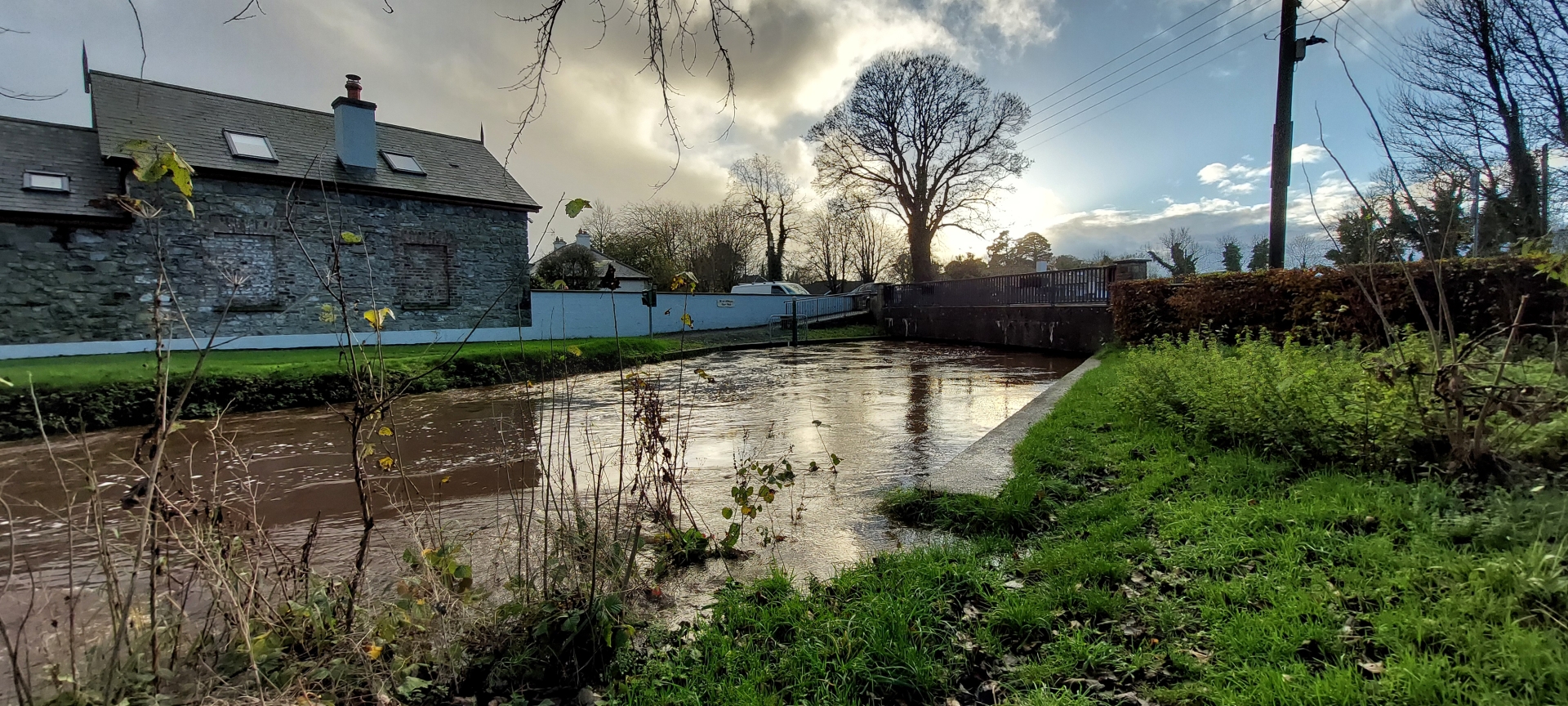
The playground in Mountmellick beside the Ownenass River. Photos: Leinster Express

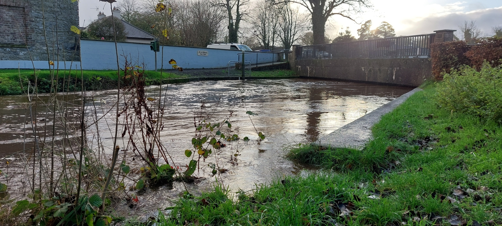
A Laois playground has been closed due to flooding, with the river beside now at flood levels.
Mountmellick's playground next to the River Owenass has been closed down by Laois County Council "until further notice".
The notice was issued on Tuesday afternoon, November 11.
While Laois is excluded from a Met Éireann Status Yellow Rain warning, several roads were closed due to flooding earlier in the day.
The Leinster Express / Laois Live took these photos showing the play boat that is now actually surrounded by water. The river has almost breached its banks.
At that time the river flowed through the playground and into the N80 road beside it. The playground was subsequently closed for over six months because of potential contamination by the river.
However this time council staff on site say that the closure is only a precaution in case the situation deteriorates further. The site is also being utilised for flood prevention equipment.
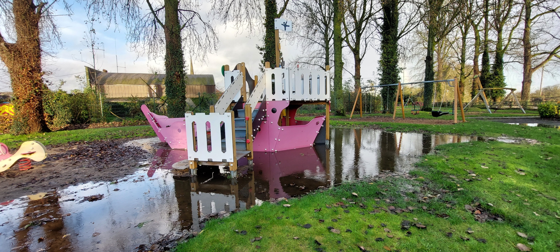
Flooded play area in Mountmellick park.
The town is awaiting flood defences, following a catastrophic flood eight years ago this month that damaged 90 properties and shut down the N80 road through the town centre.
The plans for the flood defences are currently on view in Mountmellick library, while Compulsory Purchase Orders are underway to buy lands to build them.
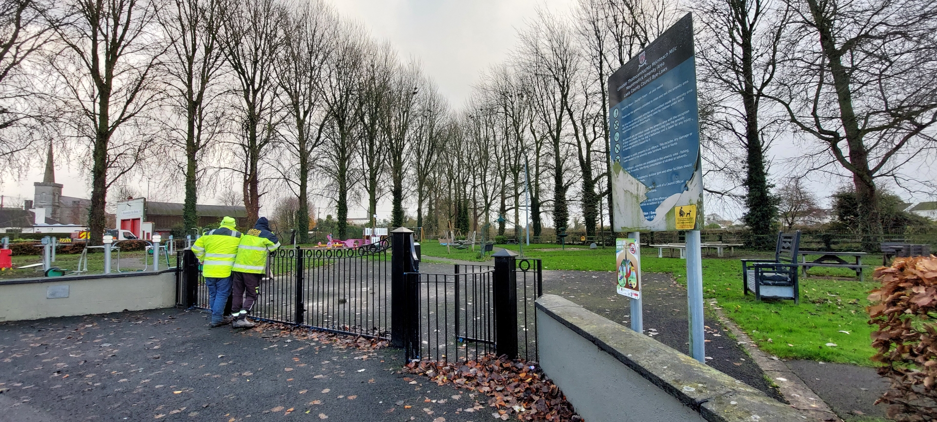
Laois County Council staff shutting the playground in Mountmellick.
The multi million Mountmellick flood relief scheme will comprise a series of walls and embankments along the Owenass, Clontygar, Pound and Garroon rivers, a surface water pumping station, the realignment of a length of the Clontygar, reconstruction of Owenass Bridge at the Four Roads, the provision of a demountable flood gate at Convent Bridge, the provision of eighteen culverts and the removal of vegetation.
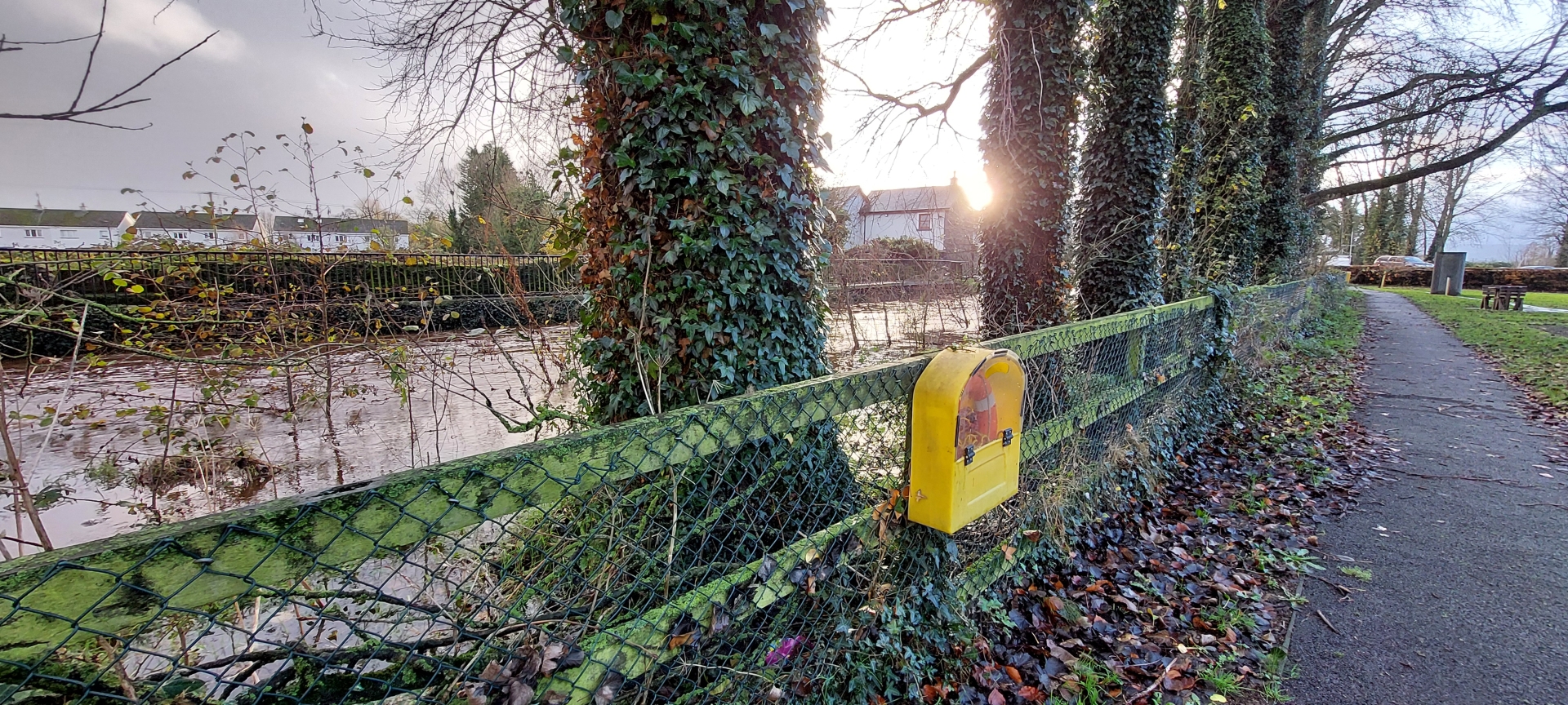
The fence between the Owenass River and Mountmellick's playground.
There will be flood defence walls from Mill Bridge to Convent Bridge, and a pumping station in Irishtown. Walls beside the River Owenass will be half a km long and up to 3.8m tall.
Read also: Emergency vehicles respond to road crash between Mountmellick and Portlaoise
A flood wall also extends along the rear of Grove Park, and downstream of Convent Bridge, beside a stream behind Davitt Road, from Owenass Bridge to Mill Bridge. There will be flood defence walls and embankments upstream of Owenass Bridge, which will be rebuilt to let more water pass.
More flood defence embankments are to be installed at Manor Road and Manor Court, and flood defence walls and embankments along the Garroon Stream.

Subscribe or register today to discover more from DonegalLive.ie
Buy the e-paper of the Donegal Democrat, Donegal People's Press, Donegal Post and Inish Times here for instant access to Donegal's premier news titles.
Keep up with the latest news from Donegal with our daily newsletter featuring the most important stories of the day delivered to your inbox every evening at 5pm.
This publication supports the work of the Press Council of Ireland and Office of the Press Ombudsman, and our staff operate within the Code of Practice of the Press Council. You can obtain a copy of the Code, or contact the Council, at www.presscouncil.ie, Lo-call 1800 208 080 or email: info@presscouncil.ie.


