
Shoppers shocked as mop is used in bare-chested brawl inside Irish shopping centre
Search
08 Sept 2025
Please allow ads as they help fund our trusted local news content.
Kindly add us to your ad blocker whitelist.
If you want further access to Ireland's best local journalism, consider contributing and/or subscribing to our free daily Newsletter .
Support our mission and join our community now.
To continue reading this article, you can subscribe for as little as €0.50 per week which will also give you access to all of our premium content and archived articles!
Alternatively, you can pay €0.50 per article, capped at €1 per day.
Thank you for supporting Ireland's best local journalism!


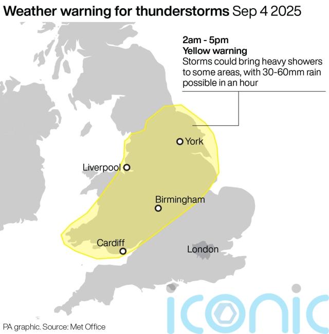
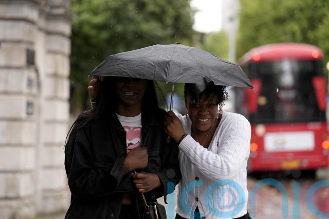
Thunderstorms could bring further rain and flooding to parts of the country on Thursday, after the wettest week in England for seven months.
A yellow warning for storms runs until 5pm, affecting much of northern England, the Midlands and parts of Wales, the Met Office said.
While most areas are likely to escape the thunder and heavy downpours, some places could see 30-60mm rain in an hour.
Nine flood alerts were in place as of lunchtime, mostly for locations near parts of the River Trent and River Tame in the West Midlands, meaning flooding is possible.
It comes after England experienced its wettest week for seven months, according to the Environment Agency.
There have been “notable” amounts of rainfall, particularly in the North West, South East and South West, all of which received more than 35mm of rain between August 27 and September 2.
Rivers levels have increased at nearly all the sites monitored by the agency, although just over a third (35%) were classed as being below normal for this time of year.
Despite the recent showers, total rainfall in England in August was only 42% of the long-term average.
Long spells of dry and hot weather over the past few months have taken their toll on the environment and agriculture, leading to hosepipe bans, drought orders, poor harvests and low water levels in reservoirs.
Both spring and summer 2025 were the UK’s warmest on record, while spring was the second driest for England since Met Office rainfall data began in 1836.
Yorkshire Water still has a hosepipe ban in place despite some recent rain, while Southern Water still has a ban in place for Hampshire and the Isle of Wight.
Dave Kaye, Yorkshire Water’s director of water services, said: “Yorkshire is in drought following an extremely dry spring and the hottest summer on record.
“While the rain, which was heavy in some areas but short-lived, has been welcome, the majority has been taken up by the extremely dry ground, as well as plants and trees.”
Thames Water still has some restrictions in place while South East Water’s hosepipe ban in Kent and Sussex also continues.
Stephen Dixon, a Met Office spokesman, said: “Some heavy and at times thundery rain is moving gradually north east today, with the potential to bring some impacts for some.
“There’s a yellow warning for thunderstorms in force until 5pm today and the warning covers much of Wales as well as northern and central parts of England.
“While not everyone will see the highest totals in the warning area, some could see 30-60mm of rain in an hour with hail and lightning additional hazards for some.
“The warning highlights potential difficult travel conditions, as well as the possibility of some flooding in some spots.”
Drivers are urged to check road conditions and change travel plans if necessary, while homeowners are asked to secure moveable objects such as bins, fences and garden furniture to avoid possible injury.

Subscribe or register today to discover more from DonegalLive.ie
Buy the e-paper of the Donegal Democrat, Donegal People's Press, Donegal Post and Inish Times here for instant access to Donegal's premier news titles.
Keep up with the latest news from Donegal with our daily newsletter featuring the most important stories of the day delivered to your inbox every evening at 5pm.
This publication supports the work of the Press Council of Ireland and Office of the Press Ombudsman, and our staff operate within the Code of Practice of the Press Council. You can obtain a copy of the Code, or contact the Council, at www.presscouncil.ie, Lo-call 1800 208 080 or email: info@presscouncil.ie.


