
Gardaí are appealing for witnesses following a serious road traffic collision in Sligo
Search
21 Apr 2026
Please allow ads as they help fund our trusted local news content.
Kindly add us to your ad blocker whitelist.
If you want further access to Ireland's best local journalism, consider contributing and/or subscribing to our free daily Newsletter .
Support our mission and join our community now.
To continue reading this article, you can subscribe for as little as €0.50 per week which will also give you access to all of our premium content and archived articles!
Alternatively, you can pay €0.50 per article, capped at €1 per day.
Thank you for supporting Ireland's best local journalism!


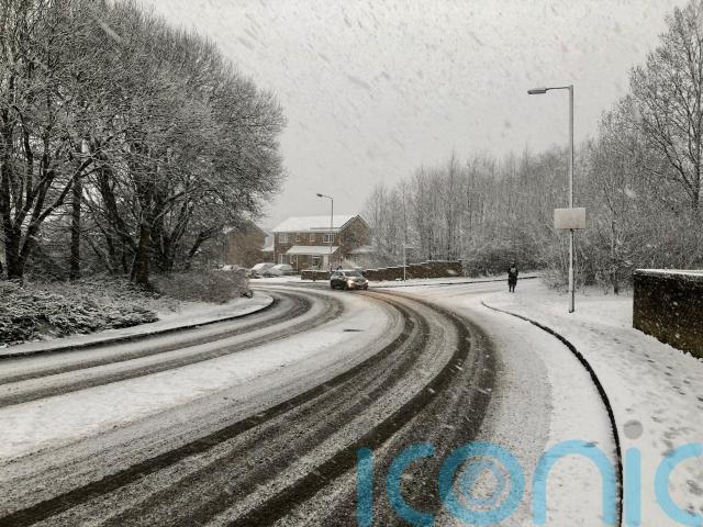
Snow and ice hitting parts of the country overnight could affect rush hour travel on Friday morning as forecasters warn that “chopping and changing” weather is set to stick around for up to five days.
Yellow weather warnings are in place for Northern Ireland, Scotland and north-west England until around 9am on Friday, with icy stretches likely to form on untreated roads amid near-freezing temperatures.
The Met Office urged people not to cycle and to take extra care when driving or walking, and warned of possible longer journey times on roads and railways.
Two yellow weather warnings are now in force for:
– Ice across Northern Ireland – Ice and snow affecting Scotland and northern England
Stay #WeatherAware ⚠️ pic.twitter.com/K330VmqMTu
— Met Office (@metoffice) February 24, 2022
More snowfall is expected to hit hilltops in some parts, while gusty winds mean blizzards are possible on higher routes.
A cold start on Friday, with frost in places – especially the north west, is set to make way for a drier and brighter day with sunny spells.
Met Office chief meteorologist Frank Saunders said: “A ridge of high pressure builds on Friday resulting in a fine, bright day for most.
“However, the winds pick up again as we head into the weekend with weather fronts bringing rain to the north and west and milder air spreads back in here”.
The Met Office said the unsettled blustery weather will stay around over the coming days, especially in the north west, although conditions are not expected to be as severe as during the past week.
A number of weather fronts are set to cross northern parts of the country and bring bouts of wet and windy weather – while southern and eastern areas are in line for the best of the fine weather over the weekend, according to the service.
It described the jet stream, which has been driving storm systems across the North Atlantic Ocean in recent weeks, as still being very active but these winds are shifting further north and may allow for more settled weather to arrive next week.
Meteorologist Alex Deakin said the weather will “remain pretty lively over the next certainly four or five days, chopping and changing day-on-day”.
Saturday is expected to be breezy, while people in the northwest have been told to brace for further strong winds and heavy rain on Sunday.
After a spell of rain across the UK on Monday, calmer weather is forecast from Tuesday, though clear skies could bring frosty mornings, the Met Office said.
The last week has seen storms Dudley, Eunice and Franklin cause problems across the country and about 400 properties have been flooded.
The Environment Agency had 31 flood warnings and 30 flood alerts in place on Thursday night.
Earlier on Thursday, snow shuttered schools in some Scottish areas and caused difficult driving conditions.
Schools were also forced to close and travellers faced disruption after much of Northern Ireland was blanketed by overnight snow.

Subscribe or register today to discover more from DonegalLive.ie
Buy the e-paper of the Donegal Democrat, Donegal People's Press, Donegal Post and Inish Times here for instant access to Donegal's premier news titles.
Keep up with the latest news from Donegal with our daily newsletter featuring the most important stories of the day delivered to your inbox every evening at 5pm.
This publication supports the work of the Press Council of Ireland and Office of the Press Ombudsman, and our staff operate within the Code of Practice of the Press Council. You can obtain a copy of the Code, or contact the Council, at www.presscouncil.ie, Lo-call 1800 208 080 or email: info@presscouncil.ie.


