
Six counties remain under weather warnings as experts warn 'more river flooding' expected


The warnings will remain in place until midnight
Experts have warned the heavy rain expected in parts of Ireland today will "lead to more river flooding".
Alan O'Reilly from Carlow Weather has said, "A showery and breezy Thursday morning with high resolution weather models continuing to show high rainfall totals for next 36 hours. Up to 100mm forecast for Wicklow Mountains with up to 66mm of that possible 24 hours. This will lead to more river flooding."
Weather warnings will remain in counties Carlow, Dublin, Kilkenny, Waterford, Wexford and Wicklow until midnight as further heavy rain and showers are expected.
Localised flooding, river flooding and difficult travel conditions are also expected so motorists have been advised to remain cautious.
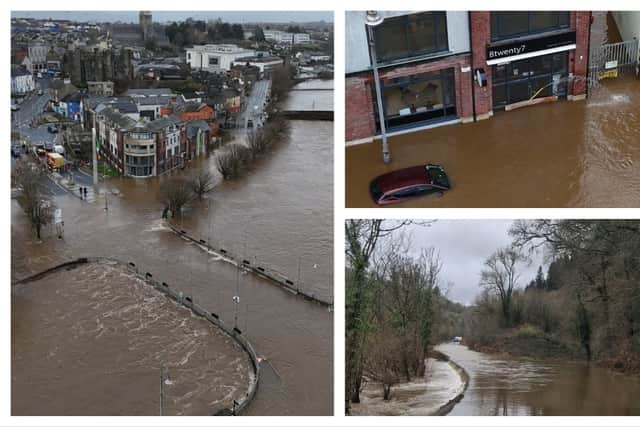
Met Éireann has also warned of localised flooding and said the next few days will bring more unsettled weather with further spells of rain and showers.
Today
Mostly cloudy this morning with scattered outbreaks of rain, though it will be dry for a time in Ulster. More persistent rain will move into the southwest by afternoon, spreading northeastwards across the country through the day and turning heavy in places. With saturated ground conditions and high river levels, there will be some localised flooding. Breezy in moderate to fresh and gusty southeast winds, strong at times. Highest temperatures of 6 to 10 degrees.
Tonight, outbreaks of rain will continue, most persistent in Ulster and Leinster, with showers following further south. The rain will gradually ease and become patchier overnight. With saturated ground conditions and high river levels, further localised flooding is possible. Blustery with moderate to fresh and gusty southeasterly winds. Lowest temperatures of 3 to 7 degrees.
Friday
Outbreaks of rain and drizzle at first tomorrow. A more persistent and heavier spell of rain will spread from the south through the morning and afternoon. Due to saturated soils and high river levels, there will be ongoing potential for localised flooding. Moderate to fresh southeast winds will ease light variable in the west and south through the day. Highest temperatures of 7 to 10 degrees.
Rain will gradually become lighter and patchier through Friday night, with occasional clear spells developing. Lowest temperatures generally of 1 to 4 degrees, but falling lower locally under longer clear spells with frost and ice possible. Light to moderate variable winds will be fresher for a time in the northeast.
Saturday
A cloudy start to the day with lingering patches of rain and drizzle. Any rain will slowly clear through the day with scattered showers and sunny spells following from the southwest. Highest temperatures of 7 to 11 degrees in light to moderate southwesterly or variable winds.
It will turn cloudy again overnight with outbreaks of rain and drizzle spreading from the southwest. Some northeastern areas may stay dry with clear spells. Lowest temperatures of 2 to 5 degrees in light to moderate west to southwest winds.
Sunday (St. Brigid's Day)
Sunday will start off quite cloudy with scattered outbreaks of rain and drizzle. The rain will clear northeastwards through the day with sunny spells and isolated showers following. Highest temperatures of 7 to 10 degrees in light to moderate northwesterly winds.
Bank Holiday Monday
A cloudy day with outbreaks of rain and drizzle. There is a chance that a more persistent spell of rain will spread from the south later in the day. A blustery day in fresh and gusty easterly winds. Highest temperatures of 6 to 9 degrees.