

1.
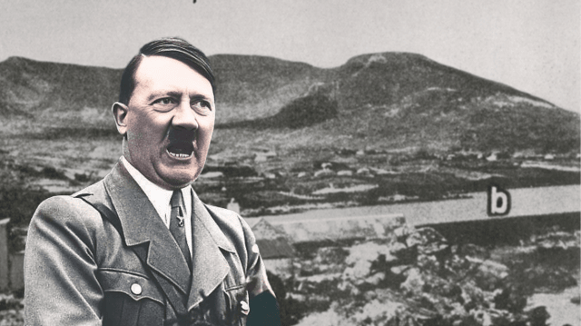
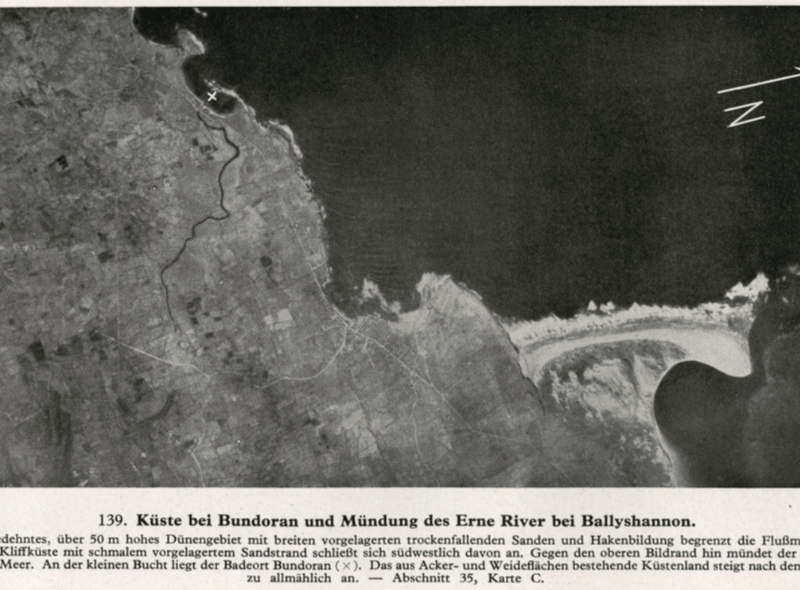
Within the booklet, there are four photographs of Bundoran, one photograph of Ballyshannon and two of Teelin. Three of the four photographs of Bundoran show the coastal scenes around Main Beach, Rougey Rocks, and Donegal Bay. These photographs were either tourist photographs that the Nazis used for reference, or they could have been taken by the Nazi spies in Donegal. The most striking photograph is the aerial photograph of Bundoran, which captures an overview of the Drowes River and the Erne estuary. The Donegal Corridor was clearly on the Nazis' radar. This Luftwaffe aerial photograph was taken in 1939 at the start of World War II. It is a unique image because it is the only aerial photograph that the Nazis took of Donegal. The Nazis made a couple of mistakes in the caption of this photograph. They erroneously referred to the Drowes River as the Bradóg River, and they also claimed that the X on the aerial photograph indicated that Bundoran is located on the small bay, when the X is actually positioned by the Drowes estuary. The Nazi spy who detailed the aerial photograph in the Bundoran area provided incorrect information. One possible candidate for the spy who took the Teelin photographs in Donegal is Nazi professor, Dr Ludwig Mühlhausen. He lived in Teelin in 1937. Mühlhausen took photographs, scoped out the potential secret U-boat submarine base and reported to the S.S. .
2.
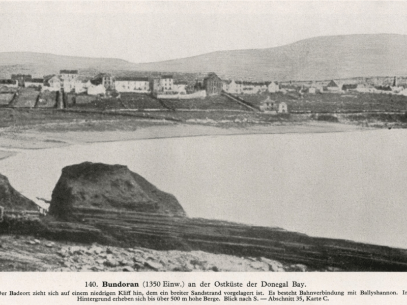
Within the booklet, there are four photographs of Bundoran, one photograph of Ballyshannon and two of Teelin. Three of the four photographs of Bundoran show the coastal scenes around Main Beach, Rougey Rocks, and Donegal Bay. These photographs were either tourist photographs that the Nazis used for reference, or they could have been taken by the Nazi spies in Donegal. The most striking photograph is the aerial photograph of Bundoran, which captures an overview of the Drowes River and the Erne estuary. The Donegal Corridor was clearly on the Nazis' radar. This Luftwaffe aerial photograph was taken in 1939 at the start of World War II. It is a unique image because it is the only aerial photograph that the Nazis took of Donegal. The Nazis made a couple of mistakes in the caption of this photograph. They erroneously referred to the Drowes River as the Bradóg River, and they also claimed that the X on the aerial photograph indicated that Bundoran is located on the small bay, when the X is actually positioned by the Drowes estuary. The Nazi spy who detailed the aerial photograph in the Bundoran area provided incorrect information. One possible candidate for the spy who took the Teelin photographs in Donegal is Nazi professor, Dr Ludwig Mühlhausen. He lived in Teelin in 1937. Mühlhausen took photographs, scoped out the potential secret U-boat submarine base and reported to the S.S. .
3.
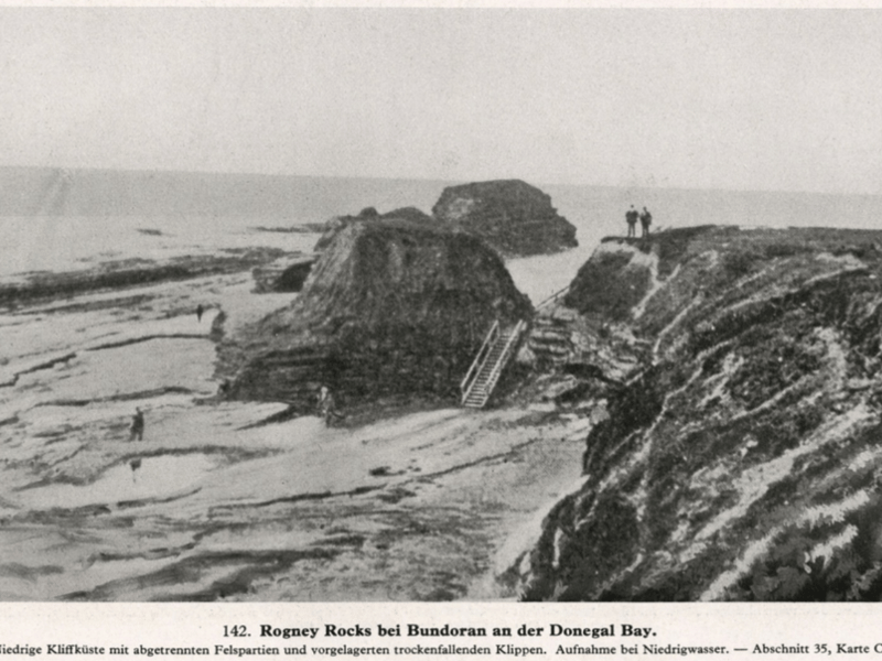
Within the booklet, there are four photographs of Bundoran, one photograph of Ballyshannon and two of Teelin. Three of the four photographs of Bundoran show the coastal scenes around Main Beach, Rougey Rocks, and Donegal Bay. These photographs were either tourist photographs that the Nazis used for reference, or they could have been taken by the Nazi spies in Donegal. The most striking photograph is the aerial photograph of Bundoran, which captures an overview of the Drowes River and the Erne estuary. The Donegal Corridor was clearly on the Nazis' radar. This Luftwaffe aerial photograph was taken in 1939 at the start of World War II. It is a unique image because it is the only aerial photograph that the Nazis took of Donegal. The Nazis made a couple of mistakes in the caption of this photograph. They erroneously referred to the Drowes River as the Bradóg River, and they also claimed that the X on the aerial photograph indicated that Bundoran is located on the small bay, when the X is actually positioned by the Drowes estuary. The Nazi spy who detailed the aerial photograph in the Bundoran area provided incorrect information. One possible candidate for the spy who took the Teelin photographs in Donegal is Nazi professor, Dr Ludwig Mühlhausen. He lived in Teelin in 1937. Mühlhausen took photographs, scoped out the potential secret U-boat submarine base and reported to the S.S. .
4.
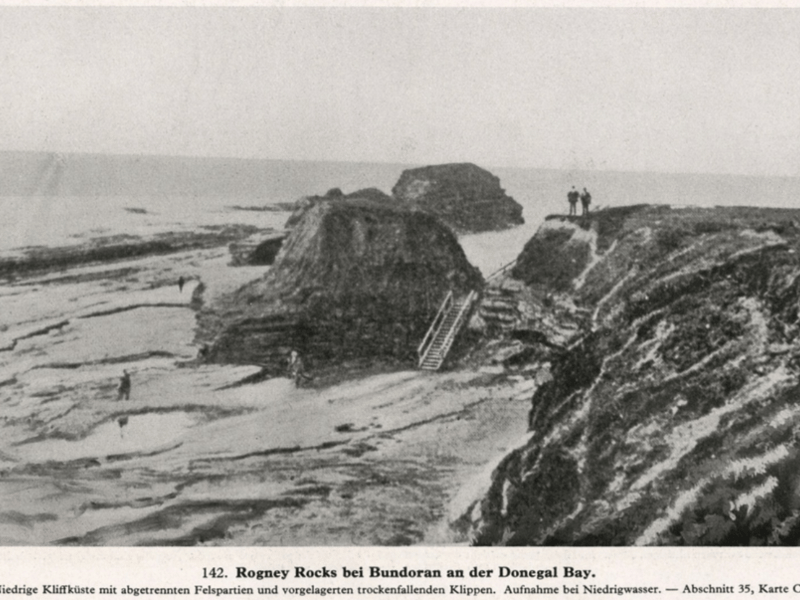
Within the booklet, there are four photographs of Bundoran, one photograph of Ballyshannon and two of Teelin. Three of the four photographs of Bundoran show the coastal scenes around Main Beach, Rougey Rocks, and Donegal Bay. These photographs were either tourist photographs that the Nazis used for reference, or they could have been taken by the Nazi spies in Donegal. The most striking photograph is the aerial photograph of Bundoran, which captures an overview of the Drowes River and the Erne estuary. The Donegal Corridor was clearly on the Nazis' radar. This Luftwaffe aerial photograph was taken in 1939 at the start of World War II. It is a unique image because it is the only aerial photograph that the Nazis took of Donegal. The Nazis made a couple of mistakes in the caption of this photograph. They erroneously referred to the Drowes River as the Bradóg River, and they also claimed that the X on the aerial photograph indicated that Bundoran is located on the small bay, when the X is actually positioned by the Drowes estuary. The Nazi spy who detailed the aerial photograph in the Bundoran area provided incorrect information. One possible candidate for the spy who took the Teelin photographs in Donegal is Nazi professor, Dr Ludwig Mühlhausen. He lived in Teelin in 1937. Mühlhausen took photographs, scoped out the potential secret U-boat submarine base and reported to the S.S. .