
Galway weather: Met Eireann update forecast pinpointing warmest days for July
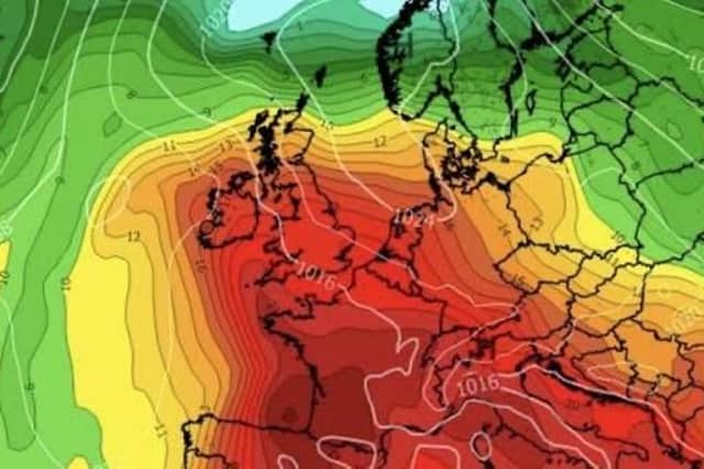

The long range prediction is looking good
A new month has kicked off and hopefully is bringing some newer, hotter weather with it.
Met Eireann has released its forecast for the first few days of July including an early indication of how things may turn out as the month goes on.
The National Forecaster has stated that Friday, Saturday and Sunday are all looking good so far with 24C maximums on the cards.
As well as this, a further outlook is hopeful for temperatures between the low to mid twenties throughout July as we hope to get back to some summer sun.
Wednesday will start off with isolated showers with some early sunny spells breaking in between.
The west will be hampered by cloud as mist and fog are also being forecast by Met Eireann.
That cloud will continue into the nighttime as temperatures drop to a cooler 10C.
Thursday will be largely dry with a mix of cloud and sunny spells. The west will avoid any big showers that will hit the rest of the country with temperatures reaching peaks of 22C in places.
Temperatures will drop to around 9C staying dry and cool across the country throughout the night.
For Friday, Met Eireann say: “Largely cloudy with limited sunny spells, the best of which will be in the south and east. Some light rain and drizzle at times, most frequent in the northwest.
“Highest temperatures of 16 to 20 degrees over the northwestern half of the country, ranging 20 to 24 degrees further south and east, all in light to moderate southwesterly breezes.”
For Saturday and Sunday they added: “Indications are for largely cloudy days with patchy rain and drizzle, most frequent in the northwest where it will be coolest.
“The best of the sunny spells will be in the south and east where it will be warmest.
“Highest temperatures of 16 to 21 degrees generally but reaching up to 23 or 24 degrees in the southeast, all in mostly moderate, occasionally fresh southwest to west winds.”
Looking further into the month they added: “Current indications are for high pressure to become more dominant early next week becoming largely dry away from the north.
“Temperatures widely reaching the low to mid-twenties.”