
Met Eireann issue four new weather warnings for Ireland mentioning snow for first time
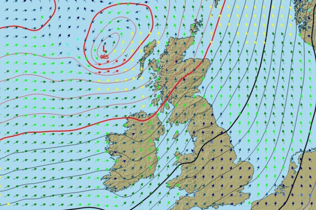

The possibility of snow has been forecast in one of the warnings which will be short and sharp
Met Eireann has issued a new weather warning for Galway alongside other counties until Tuesday as part of a quadruple alert for Ireland.
Seven counties have been given the alerts which will last until midnight tonight or 4am on Tuesday depending on where you are in the country.
Here, the status yellow wind and rain warning for Galway, Mayo and Sligo will last for the latter amount of time coming into play at 3pm on Monday with Met Eireann warning “spells of heavy rain along with strong and gusty southeast winds”.
They added: “Be aware of potential impacts: Debris, loose objects displaced; difficult driving and cycling conditions and localised flooding possible.”
A variation of the same alert is in place for Cork and Waterford and Kerry separately until midnight but starts at 1pm while Donegal’s will start at 7pm and last until 4am with “snow on hills” forecast.
Here’s Met Eireann’s forecast for the start of the week:
Monday: “This morning will be mostly dry and bright with frost and icy patches, away from the southwest, which will gradually clear. Cloud will increase from the southwest. Through the afternoon, rain will spread northeastwards over Munster, Connacht and much of Leinster with localised flooding and southeasterly winds increasing very strong and gusty. Ulster will stay dry until after dark. Highest temperatures of 4 to 7 degrees generally but milder in the southwest.”
Tonight: “The rain and strong winds will spread to Ulster through the evening with some wintry falls on hills for a time. Overnight, the rain will turn more showery elsewhere and the winds will ease. Lowest temperatures of 2 to 7 degrees generally but milder near southern and southwestern coasts.”
Tomorrow: “Tuesday will bring scattered showers and sunny spells with rain lingering for a time in the far north. More frequent and heavier showers will follow from the southwest later. Highest temperatures of 7 to 12 degrees in moderate southwest winds, fresher along the Munster coast, but easing variable over Ulster.
“Tuesday night will bring further showers, becoming largely confined to western parts later. Lowest temperatures of 3 to 8 degrees in a moderate south to southwest wind.”