
ALERT: Met Éireann's Irish weather forecast for next few days and the weekend is in...
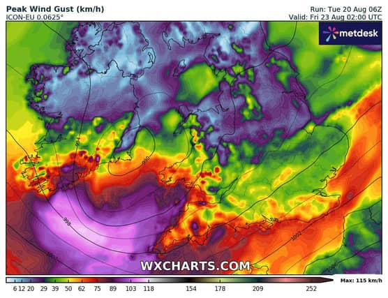

Irish weather forecast for the coming days is in...
Wednesday: It will be breezy and mostly cloudy. There will be rain and drizzle across the northern half of the country in the morning but it will become drier in most areas during the afternoon.
Strong winds and rain will move into the west during the evening and will coincide with very high tides, which may result in coastal flooding and wave overtopping.
Highest temperatures of 14 to 18 degrees with moderate to fresh and gusty south to southwest winds, strengthening later.
National Outlook: Wet and windy Wednesday night with heavy and persistent rain moving eastwards over the country, bringing the chance of flooding, accompanied by fresh to strong and gusty southerly winds.
Winds will ease westerly as the rain clears eastwards. Lowest temperatures 12 to 16 degrees.
The last of the overnight rain and strong winds will clear from the east of the country early on Thursday morning, then the day will be largely dry with sunny spells and well scattered showers.
Highest temperatures 16 to 19 degrees in mostly moderate west or southwest winds.
Another spell of windy and very wet weather will come through on Thursday night bringing a chance of flooding in places. Lowest temperatures 10 to 12 degrees with variable winds.
The heavy rain is expected to move through Friday morning, once again clearing to sunshine and blustery showers. Highest temperatures 14 to 18 degrees.
Sunshine and showers on Saturday, highest temperatures 14 to 18 degrees with mostly moderate westerly winds.
Current indications are that unsettled conditions will persist through Sunday and in to next week.