
Met Éireann issues weather warning with freeze and snow on way #sneachta
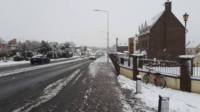

Laois council workers have been put on standby as Met Éireann issued a weather warning for Laois and most of Ireland as temperatures are set to plummet in the coming days brining wintry weather with it.
The forecaster says it will be very cold on Thursday night with temperatures likely to fall well below zero in places. Included in the forecast is some wintry precipitation that could mean snow for parts says the forecaster.
The Status Yellow low temperature & ice warning, which was issued this Wednesday, November 29, will come into effect for Laois and 21 counties from 6 pm on Thursday.
It states: "Very cold with temperatures expected to fall below -3 degrees in many areas. Frost and ice developing will cause hazardous travelling conditions," states the warning will will remain in place until 12 midday on Friday." MORE DETAILS BELOW TWEET.
The weather warning applies to Carlow, Kildare, Kilkenny, Laois, Longford, Louth, Meath, Offaly, Westmeath, Wicklow, Cavan, Donegal, Monaghan, Clare, Cork, Kerry, Limerick, Tipperary and all of Connacht.
Local authorities crews across the country have been placed on standby ahead of the warning taking effect.
National Forecast Issued at 1.55pm on November 29
Wednesday: Cold with bright or sunny spells developing, along with lingering mist or fog patches. There'll be a few light showers near coasts. Highest temperatures of 3 to 7 degrees with light east to northeast breezes.
A cold but mainly dry with long clear spells. A few showers will develop in eastern counties overnight, turning wintry on high ground. Frost and some icy patches also with lowest temperatures of -2 to +2 degrees and light to moderate north to northeast breezes.
Thursday: Cold, breezy and mainly dry with frost clearing and bright or sunny spells developing. There'll be a few showers in eastern areas. Highest temperatures of 3 to 6 degrees with moderate north to northeast breezes.
Thursday night will be cold and mainly dry with clear spells and with widespread frost and some icy patches. Some patches of mist and fog also. Scattered showers will affect western parts of Connacht and Ulster and also some areas along the east coast. Some of these may be wintry. Lowest temperatures of -4 to +1 degrees, with light northerly or variable breezes.
Friday: Morning, frost, and any mist or fog will gradually clear. The first day of the meteorological winter will be cold and mainly dry with sunny spells. There'll be a few showers in coastal areas. Highest temperatures of 3 to 6 degrees with light to moderate northwesterly breezes.
Friday night will be cold and mainly dry with clear spells and some patches of mist or fog. Some showers will develop in the west and north, possibly turning wintry in the north. Lowest temperatures of -3 to 0 degrees with frost and some icy patches.
Saturday: Another cold day with sunny spells for a time. Cloud will increase from the west later. Highest temperatures of just 2 to 6 degrees with light west to southwest breezes. Through Saturday evening and night, there's a possibility of rain and drizzle spreading eastwards and turning to sleet or snow for a time as it does so. Lowest temperatures of -2 to +2 degrees.
Sunday: Cold and mainly dry with sunny spells. Highest temperatures of 3 to 6 degrees with light breezes.
Current indications suggest that Monday and Tuesday of next week will continue cold and mainly dry.