
IRELAND WEATHER FORECAST: Gales, heavy rain and even snow but Met Eireann saying nothing yet about Storm Antonio

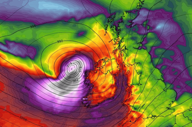

Speculation is growing that the first named storm of the 2022/23 season could hit just days after Easter.
No extreme weather events were declared during the winter but Storm Antonio looks could be a spring bolter.
Met Eireann have yet to forecast exactly what will happen but has forecasted gales, heavy rain and even snow from Tuesday when conditions are expected to go downhill.
National Forecast issued on April 8 at 5:23pm
TUESDAY: Exact details are still a little uncertain for Tuesday but currently the forecast suggests southerly winds veering westerly will be strong and gusty with gales in some coastal areas.
Rain will continue to extend northeastwards becoming widespread, and at times heavy, during the morning before clearing to showers later in the day. Highs will range from 7 to 11 degrees.
Turning cold and remaining windy on Tuesday night with widespread showers and gusty conditions at times. There will be a chance of hail and isolated thunderstorms and a few brief wintry flurries over high ground can't be ruled out. Lows will range from 1 to 4 degrees generally.
Wednesday: Remaining windy on Wednesday with frequent squally showers feeding in from the west throughout the day. Some of the showers with be heavy with a chance for further isolated thunderstorms and hail and the showers may merge to longer spells of rain at times. Highs on 8 to 10 degrees in fresh to strong and gusty westerly winds.
FURTHER OUTLOOK: Remaining generally unsettled for the rest of the week and further spells of wet and windy weather.