
Latest weather model shows a change in where in Ireland snow could fall on Thursday


The latest high resolution weather model shows a slight change in where snow is expected to fall in Ireland throughout Thursday.
The latest high resolution weather model shows a slight change in where snow could fall in Ireland throughout Thursday.
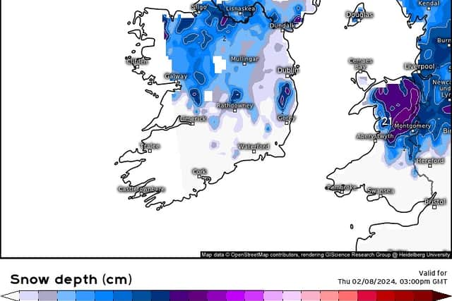
In a post this morning, Weather Alerts Ireland shared an image of the most up to date forecast for snow for Ireland.
With the post, it states that there is a risk of snow for much of the country on Thursday.
It adds that the snow is likely slightly more north than the previous model but there still a chance of snow from around the Clare/ Galway border across to Mid Leinster with higher ground likely to see some decent accumulations.
As of 11am on Wednesday, Met Eireann has issued one Status Yellow Snow Ice Warning for Cavan, Monaghan, Galway, Mayo, Sligo, Leitrim and Roscommon with a second warning covering Donegal.
The Snow Ice Warning for Cavan, Monaghan, Galway, Mayo, Sligo, Leitrim and Roscommon comes into effect at 2am on Thursday and remains in place until 6pm on Thursday.
It warns that a band of rain will turn increasingly to sleet and snow on Thursday with impacts including ice on untreated surfaces, hazardous driving conditions, travel disruption and poor visibility.
The Snow and Ice Warning for Donegal comes into place at 11am on Thursday and remains in place until 8pm on Thursday.
Separately the UK Met Office has issued a Status Yellow Snow Warning for Antrim, Armagh, Down, Fermanagh, Tyrone and Derry from 6am on Thursday until 6pm on Friday.