
Grim weekend ahead as experts warn frost, ice and freezing fog 'will be an issue'
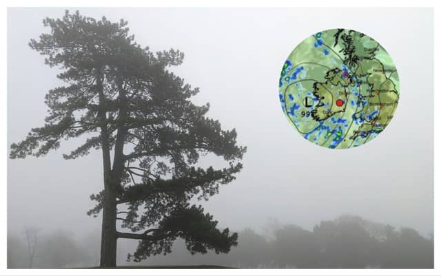

Temperatures are set to plunge in the coming days
Met Éireann has delivered a grim forecast for Ireland for the days ahead as frost, ice, and freezing fog are expected as temperatures are set to plunge yet again.
While many areas will be dry and calm this weekend, there will be some well scattered showers with lingering fog, owing to a slack area of low pressure. Heavier and more organised bands of showers will feed in from the Atlantic later Sunday and into Monday.
No weather warnings have been issued as of yet but freezing temperatures are on the way for parts of the country giving way to black ice on roads so motorists are urged to be advised.
Alan O'Reilly has said while there is still some uncertainty around a possible Beast from the East heading our way next week, fog "will be an issue" for some parts.
Today
A mix of sunshine and scattered showers this afternoon, especially across Atlantic counties, with thunderstorms and hail at times. Highest temperatures of 5 to 10 degrees, coolest in Ulster, with light to moderate southerly or variable breezes.
Long dry spells and further thundery showers tonight, merging to more general falls of rain for south and southwest counties later. Some thunderstorms and hail will occur too. Frost will set in where skies remain clear with the chance of icy stretches. Cold with lowest temperatures of -1 to +3 degrees in light to moderate southeast breezes with some mist and fog patches developing.
Friday
On Friday morning, any frost or fog will soon clear. Some bright or sunny spells but scattered heavy showers, mainly for southern and eastern areas to begin with the chance of hail and isolated thunderstorms, will extend northeastwards through the day. Highest temperatures of 5 to 9 or 10 degrees in a light to moderate southeasterly or variable breeze.
Some scattered showers will occur at night but more notably, widespread fog or freezing fog will develop in near calm. Lowest temperatures of -2 to +3 degrees, coldest away from eastern fringes.
READ NEXT: Young girl rushed to Temple Street hospital following crash as Gardaí appeal for witnesses
Saturday
While it will be dry across most areas, overnight fog will linger in places with generally cloudy skies for the day. Isolated showers or light rain and drizzle will affect southern and eastern fringes. A cool still day with highest temperatures of just 4 to 8 degrees in just light southeast or variable breezes.
A similar night with stubborn areas of fog, as well as frost where skies clear. Lowest temperatures of -2 to + 3 degrees in near calm.
Sunday
Overnight mist and fog will once again linger in places for the day. Overall dry for daylight hours with the best of the sunny spells for eastern counties. Rain will push into western counties later in the evening. Highest temperatures of 6 to 9 degrees in just light to moderate southeasterly winds.
Sunday night will be mostly frost-free but with bands of showers moving in from the Atlantic, especially affecting western half of the country. Lowest temperatures of 2 to 6 degrees in mostly moderate southeast winds.
READ NEXT: 'Evil' stepmother, who murdered 4-year-old boy, is named after judge lifts reporting restrictions
Monday
A dull wet day with widespread outbreaks of showery rain. Highest temperatures of 6 to 9 degrees in moderate southeasterly winds.
Some uncertainty to the detail for next week but there is a signal for cool or cold weather.