
How far is your Kilkenny home from the emergency department?
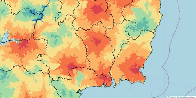

A software engineer from County Mayo has been crunching the numbers to uncover the distances people across Ireland have to travel to reach the nearest emergency department.
Ryan Jennings told Kilkenny Live that growing up far from cities ‘has always kept the thought in the back of my mind that I may need to get to an emergency department in a hurry and where is the overlap between the closest hospitals’.
He uncovered that the percentage of County Kilkenny that can reach an emergency department in:
- < 10 minutes = 2.86%
- < 20 minutes = 42.79%
- < 30 minutes = 90.56%
- < 40 minutes = 100.0%
Mr Jennings admitted that coming from the West of Ireland, ‘coastal areas here haven’t seen as much development’ and added that he ‘would like equality in access to healthcare and services’.
“This has only been amplified for me seeing people across the country calling for better public services and article after article on atrocious wait times,” he added.
“For example, I’ve seen people protesting for years for a hospital for North-West Clare and to lower the stress put on University Hospital Limerick.
“It was only recently with this project that I was able to quantitatively see the issue displayed before me with the colour-coded map.”
Mr Jennings stated that his research into Voronoi diagrams and Isochrones led him to realise that technology could be leveraged to realise his vision.
“If it ebenefits one person or even encourages greater spending in infrastructure then I’ll consider the project a success,” he concluded.
To explore the full map, see ryanjennings.ie.