
ALERT: Met Éireann's five-day forecast has one major prediction until 'at least Thursday'
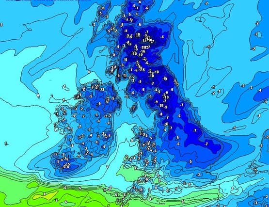

Check this out!
Met Éireann's five-day forecast has one major prediction until "at least Thursday".
Sunday and Sunday night
Cool with some bright or sunny spells. Scattered showers will occur, mainly over the northern half of the country, with just isolated showers further south. Highest temperatures of 6 to 9 degrees in no more than moderate northwesterly winds.
A mix of cloud and clear spells on Sunday night with well scattered showers. Mist and fog will form in parts too in just light westerly breezes. Rather cold with lowest temperatures of -1 to +3 degrees with a slight frost under clearer skies.
Monday
Hazy sunny spells and well scattered showers to start tomorrow with outbreaks of rain moving into the north, slowly sinking southwards.
Turning colder and clearer behind the rain with highest afternoon temperatures in the north of just 4 or 5 degrees.
Milder further south in the early afternoon with temperatures reaching 6 to 9 degrees, all in light to moderate northwesterly breezes. Turning very cold from the north in the evening with icy stretches developing.
National Outlook
Very cold until at least Thursday with frost, ice and some possible wintry falls. Some uncertainty to the midweek detail however.
MONDAY NIGHT: Long clear spells will develop as the last of the rain clears southern counties early in the night.
Very cold with lowest temperatures of 0 and -4 degrees leading to widespread sharp frost and possible icy stretches.
Wintry showers will later move into north facing coasts later, in a mostly light northerly airflow.
TUESDAY: Very cold as an Arctic airflow feeds down but with plenty of sunshine too, and with just light northerly breezes.
Some well scattered sleet or snow showers will stream into the north and northwest but with a lot of dry weather elsewhere.
Highest temperatures will range just 3 to 6 degrees with light to moderate northerly breezes.
A few wintry showers will continue near northern coasts overnight, while staying dry and clear elsewhere. Another icy cold night with a widespread sharp or severe frost in sub-zero temperatures.
WEDNESDAY: A very cold frosty start with icy stretches, but with a good deal of dry bright sunshine about too. Many areas will stay dry for the day in moderate east to southeast winds.
During the afternoon however, cloud and wintry rain may feed into the southwest. Highest temperatures will again range just 3 to 6 degrees. Some uncertainty after-dark but widespread wintry outbreaks may continue to feed up from the southwest. Cold with lows of -2 to + 2 degrees.