
ALERT: Met Éireann's weather forecast for week ahead has some thunderstorm predictions

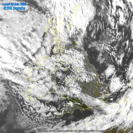

The Irish weather forecast for the coming week is a bit of a mixed bag
Tuesday: Tuesday morning's weather will be cloudy with patches of light rain and drizzle. Becoming mainly dry across Ulster and Connacht by afternoon with rain and drizzle becoming confined to Leinster and Munster.
Highest temperatures of 15 degrees in the northwest to 22 degrees in the south, in moderate southwesterly winds, decreasing light to moderate later.
Overview: It'll continue changeable and mixed for the rest of the week, with some rain at times, but drier sunnier interludes too. It'll be relatively mild and it'll be humid at times, with the warmest conditions in the south and east. Breezy at times too.
Tuesday night will bring a fair deal of cloud but with a lot of dry weather and just a few patches of light rain or drizzle about, mainly in southern parts. It will be rather misty on southern coasts.
A mild and humid night, especially in the south, with lowest temperatures of 11 degrees in the northwest to 15 degrees in the south in light southwest or variable breezes.
Wednesday: Wednesday will bring a good lot of dry weather for the morning and afternoon, with just a few scattered showers. While there'll be a good lot of cloud, there'll be some bright or sunny spells.
A spell of rain will spread from the west during the evening, becoming heavy at times with the chance of thunder.
There'll be some hill and coastal mist and fog too especially further south. Highest temperatures of 17 to 22 degrees with southerly winds increasing mostly moderate, becoming fresh later along the west coast.
Rain will clear eastwards on Wednesday night with clear spells and a few showers following. It will be a cooler night than the previous couple, with lowest temperatures of 9 to 13 degrees in mostly moderate southerly winds, veering westerly as the rain clears and fresh at times in western and southwestern coastal parts.
READ NEXT: Tipperary man caught driving with EIGHT people on bonnet and roof of car at Donegal Rally
Thursday: Thursday will be a breezy day with some spells of sunshine in the morning and just a few showers.
It'll become cloudier through the afternoon, with more in the way of showers around, especially in the west and north, while a spell of more persistent rain is likely to spread eastwards later on.
Highest temperatures of between 15 and 19 degrees in fresh and gusty southwesterly winds, strong at times in western and southern coastal parts.
Thursday night will be mostly cloudy with further outbreaks of rain and drizzle at times, possibly heavy at times in the north and northwest.
There'll be hill and coastal mist and fog too. A mild and humid night with lowest temperatures of 13 to 16 degrees in moderate to fresh and gusty southwest winds.
Friday: Friday will be another breezy day with a good deal of cloud and further outbreaks of rain and drizzle, along with some hill and coastal mist and fog.
The rain will possibly be heavy at times in the west and north.
It'll be drier further to the east and south, where there'll be some bright or sunny spells. Mild or warm and humid with highest temperatures of 17 to 23 degrees, warmest in the east.
Further outlook: Our weather will remain changeable next weekend, with some rain at times, but some decent drier sunnier interludes likely too. Continuing relatively mild.