
Drone survey is determining extent of invasive plant along some Tipperary waterways
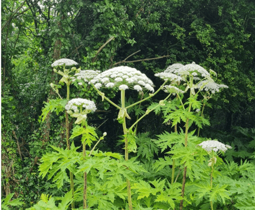

The survey gathering information on the extent of giant hogweed infestation is being conducted along rivers and streams in the Cappawhite area
A drone survey is currently being carried out in the Cappawhite area of county Tipperary to determine the extent of giant hogweed infestation along local rivers and streams
Giant hogweed, also known as Heracleum Mantegazzianum, is a non-native invasive hazardous plant, which can cause serious skin burns and other health issues.
Children are particularly at risk. Severe infestations occur along the Toem, Cappawhite and Cahernahaille tributaries of the upper Mulkear/Dead River catchment area.
The Local Authority Water Programme (LAWPRO) in partnership with the local community, Tipperary County Council and other partners will work to develop a remedial action plan to control its spread and works towards its eradication.
The drone aerial survey of the affected river corridors began on Thursday, June 27 and continues until this Thursday, July 11 to determine the location and extent of the giant hogweed infestation.
This work will be carried out under the Farming for Water European Innovation Partnership (EIP) Project, which is working with farmers and landowners to address issues affecting water quality.
The survey will also help inform a broader understanding of issues affecting water quality in the catchment.
If you require any further information or wish to contact the Farming for Water EIP project team email [email protected] or phone Tipperary County Council on 0818 065 000.