
WATCH: Huge bog fire consumes trees near Portarlington in Laois

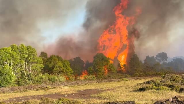

Firecrews from Laois and Offaly fight flames as smoke fills skies
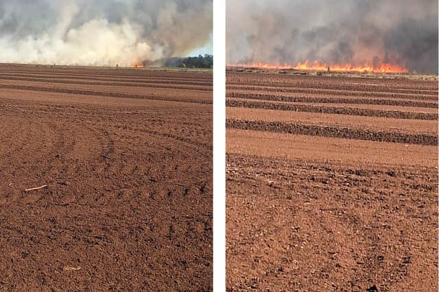
Firefighters have attended a huge bog fire near Portarlington that began on Sunday evening, May 19 shortly before 6pm.
Smoke was visible across north Laois from the fire that started on a working bog on Walsh Island, between Portarlington and Mount Lucas windfarm.
Fire crews from Laois and Offaly fought the fire, after being alerted by locals, who directed them from the roadside.
A frightening video was taken of the fire by meteorologist Cathal Nolan, Ireland's Weather Channel (warning, expletives in video).
A Condition Orange – High Fire Risk warning was issued by the Department of Agriculture, which runs from 3pm on Thursday to midday on Monday, 19 May.
"Given the fire risk on bog and mountain land in Spring, it is important that no one should start an illegal fire in these areas. Wildfires can put homes and livelihoods at direct risk, lead to unnecessary diversions of vital emergency service resources and cause considerable disruption to rural communities, wildlife and habitats. We have seen this unfold for real in some of our rural communities in recent weeks during the unusually dry Spring. Nobody should light fires in bogs, forests or other potentially flammable areas at this time of year.” said Minister for Agriculture Martin Hayden.
Rain with thunder is expected in Leinster later this Monday, and on Tuesday, according to Met Éireann.
"Mostly sunny to begin today, Monday, apart from patchy cloud and the chance of isolated showers near the east coast. Showers will develop more widely this afternoon and evening, some of them heavy with spot flooding and isolated thunderstorms possible, mainly across the southern half of Leinster. A little cooler than recently with highest temperatures ranging from 14 to 16 Celsius in the east and northeast of the province, with 17 to 19 Celsius elsewhere. Light to moderate easterly or variable breezes may be fresh at times along parts of the east coast this morning.
"Most places will become dry tonight, with patchy cloud and clear breaks, with just the odd shower possible overnight. Lowest temperatures of 3 to 8 Celsius in light easterly or variable breezes.
"Largely dry with variable cloud and sunshine to begin on Tuesday, but showers will soon develop, some of them heavy with spot flooding and isolated thunderstorms possible. Cloud will gradually build from the southwest during the afternoon. Highest temperatures of 16 to 19 Celsius in light southerly or variable breezes," say Met Éireann.