
ALERT: Met Éireann's five-day forecast predicts 'thunderstorms and spot flooding'

Check this out!
Thursday: Thursday morning will be dry with hazy sunshine, though there is the chance of a few showers in the west and southwest. Scattered heavy showers will develop through the afternoon and evening with thunderstorms and spot flooding possible. Very warm with light winds and highest temperatures of 22 to 26 degrees, though sea breezes will keep coastal areas cooler.
National Outlook
Overview: Staying warm but unsettled with frequent and widespread showers, turning heavy at times with thunderstorms possible.
Thursday night: Any remaining showers will ease early in the night and it will become dry with clear spells for a time. Further showers will push into the south and southwest towards morning, turning heavy in places. Mild again with temperatures not falling below 13 to 16 degrees in light southeasterly winds.
Friday: Heavy and persistent showers will spread northwards to most areas through the day, with isolated thunderstorms possible. Not just as warm as previous days with highest temperatures of 19 degrees in the south to 24 degrees in the north in a light to moderate southeasterly breeze.
Friday night: A very mild night with temperatures not falling below 14 to 16 degrees. Scattered showers will continue to feed up from the south in light southerly winds, with some heavy downpours.
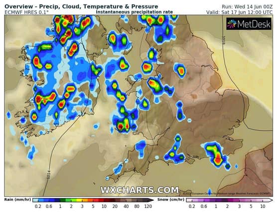
Saturday: Widespread heavy showers on Saturday, with thunderstorms and spot flooding possible. Highest temperatures of 19 to 23 degrees in light to moderate southeasterly winds.
Sunday: Another showery day, with scattered showers becoming widespread through the afternoon, turning heavy at times with a chance of isolated thunderstorms. Highest temperatures of 19 to 23 degrees in light to moderate southeasterly winds.
Early next week: Showers will continue to feed up from the south for the early days of next week, with some heavy and persistent falls at times. Staying quite warm with temperatures in the low twenties.