
Carlow Weather warning 'potential storm' coming for Ireland as Met Eireann update week forecast
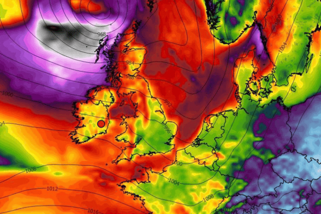

Alan O’Reilly, who has been first to predict some of the most major Irish weather events of the past 15 years, is predicting that current weather charts are showing a risk of the potential storm
A well-known amateur weather forecaster Carlow Weather is warning that a potential storm could hit Ireland next weekend.
Alan O’Reilly, who has been first to predict some of the most major Irish weather events of the past 15 years, is predicting that current weather charts are showing a risk of the potential storm on Sunday.
He said that the possible event would stay northwest of Ireland which would be “good news for those running Dublin City Marathon” but that this is not set in stone as of yet.
He told his 500,000 plus followers on social media: “Latest weather charts show potential storm Sunday staying Northwest of Ireland which would be good news for DCM runners. Still breezy but rain possibly clearing before start. This will chop and change so follow for updates.”
While Met Eireann have not updated their weather forecast just yet for that far in advance, they have said that the end of the week will turn “unsettled with wet and windy conditions as more rain on the way”.
Here is their updated weather forecast for the week ahead:
Today: “Any mist, fog or frost will clear on Monday morning with some bright spells developing. However, cloud will spread from the southeast through the day with outbreaks of rain and drizzle affecting parts of the east and south. Highest temperatures of 9 to 13 degrees in a light east to northeast breeze.
“There will be further scattered outbreaks of rain and drizzle on Monday night in parts of the south, but many parts will stay dry. Becoming cloudier overnight with rain moving into the southwest towards morning. Lows of 2 to 7 degrees in light to moderate winds.”
Tomorrow: “Generally dry at first on Tuesday morning, with some bright spells. However, rain will develop in the southwest in the morning and will spread eastwards during the afternoon and will continue through the evening. There will be some heavy falls at time. Highs of 10 to 14 degrees in light to moderate southeasterly winds.
“Rain will spread eastwards across the country overnight. It will be windy too, with moderate and at times fresh westerly winds. The rain will be heavy at times. The rain will start to clear away in the morning from the west, with scattered showers following. Lows of 5 to 9 degrees.”
Wednesday: The rain will linger in the east for a time during the afternoon. Sunshine and scattered showers for the rest of the country. A blustery day with moderate to fresh westerly winds. Highs of 8 to 12 degrees. Showers will continue along the west coast on Wednesday night but it will be largely dry elsewhere. Lows of 3 to 7 degrees.”
Thursday: “Some showers at first on Thursday morning but then rain will arrive in the southwest during the afternoon. Heavy falls are likely as it spreads to all parts during the rest of the day. It will clear away to the east overnight. At the moment, it looks like being very windy with strong and gusty northwesterly winds. Highs of 10 to 13 degrees. The rain will gradually spread to the east on Thursday night with lows of 5 to 8 degrees.”
Friday: “Scattered showers and blustery winds on Friday. Highs of 8 to 11 degrees.”