
Double Storm Boelo warning issued for Galway including orange status as Met Eireann outline five alerts area by area
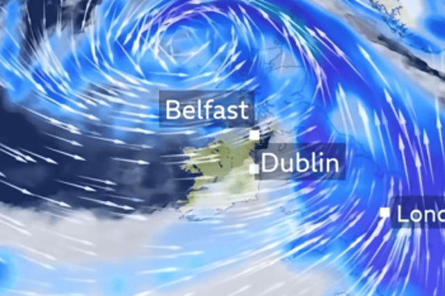

There is five Storm Boelo warnings in total across Ireland including several orange warnings
A double Storm Boelo warning has been issued for Galway including an orange alert as Met Eireann confirmed a total of five alerts across Ireland ahead of the second named storm in 24 hours.
Hours after Austen leaves, Storm Boelo will takeover bringing with it intense spells of heavy rain and wind.
First, a status yellow rain warning is in place for Galway as well as Clare, Cork, Donegal, Kerry, Leitrim, Limerick, Mayo, Sligo which will last until 3pm Saturday.
This will then be replaced by a status yellow wind warning until 12pm Sunday for all of Connacht, Clare, Kerry and Limerick and also an orange warning in that period for Galway Donegal, Leitrim, Mayo, Sligo from 2pm Saturday until 9am Sunday.
An orange rain warning is in place for Kerry until 2pm Saturday while an orange wind warning hits our neighbours Mayo, Sligo, Leitrim and Donegal until 9am Sunday morning followed by a downgraded status yellow wind warning for Donegal until 3pm later that evening.
Met Eireann is warning for Saturday: “Rather wet and windy tomorrow morning with widespread rain and fresh to strong and gusty southerly winds, reaching near gale force or gale force near coasts. The rain will be heavy at times, especially in the west and southwest with spot flooding possible. A clearance to blustery showers will follow through the afternoon, with isolated thunderstorms possible in the northwest, as winds veer southwest to west and increase strong to near gale force and gusty, reaching gale force or strong gale force near west and northwest coasts as Storm Boelo tracks to the north of the country. Highest temperatures of 12 to 15 degrees.
“Windy with fresh to strong and gusty westerly winds on Saturday night, stronger in the north and west. Showers or longer spells of rain will be heaviest and most frequent in the north and west. The winds will ease a little towards morning as Storm Boelo moves towards the North Sea. Lowest temperatures of 4 to 8 degrees, coolest in the north.”
Galway Races organisers have confirmed that there will be no racing on Saturday due to the upcoming warned Storm.
They said: “Unfortunately due to Storm Boelo we have now implemented changes to our Bank Holiday Weekend Race Programme. As a result, no racing will take place on Saturday October 24.
National Hunt racing will remain as scheduled on Sunday; the National Hunt racing from Saturday will now be held on Student Raceday on Monday with Flat Racing transferred from Monday to Tuesday.
Storm Boelo is set to track the northwest and west of Ireland on Saturday bringing strong winds and heavy rain with several warnings expected.
Michael Moloney CEO of Galway Races said the team were disappointed that Saturday’s racing cannot go ahead but believe rescheduling the fixture “is the most responsible course of action”.
He said: “Over the past two days, we have carried out continuous assessments of the track and closely monitored the weather forecast. Following discussions with Shane Ryder, Clerk of the Course, we jointly agreed that racing could not proceed safely on Saturday due to Storm Boelo and the alerts around it. It was a difficult decision to make, but the safety and welfare of our jockeys, horses, racegoers and staff must always come first.
“As we were due to race over three consecutive days, it was not possible to move Saturday’s fixture directly to Tuesday. To ensure the best possible racing lines it was decided to transfer Monday’s Flat card to Tuesday, allowing Saturday’s fixture to move to Monday instead.
“We would like to thank everyone for their understanding, patience and support as we make these changes especially our industry partners. We now look forward to three great days of racing in Ballybrit as we close out our 2026 racing season. We look forward to welcoming racegoers back to Galway over the coming days.”
Here is the rest of the weather for the Bank Holiday weekend:
Sunday: “Breezy in the morning with fresh to strong and gusty westerly winds, easing moderate to fresh towards the evening. Sunny spells and scattered showers in the morning with longer spells of rain possible in the northwest. Showers will gradually become isolated from the south through the day but with more cloud developing. Highest temperatures of 9 to 12 degrees.”
Sunday night: “Largely dry at first with light to moderate southwest to south winds. Cloud will build from the southwest with rain following into the southwest towards morning as winds become southeasterly, increasing moderate to fresh and gusty in the southwest. Lowest temperatures of 3 to 8 degrees.”
Monday: “Rain will extend northeastwards through the morning with moderate to fresh southeasterly winds. Some drier intervals will develop during the afternoon and evening but winds will veer south to southwest, increasing fresh to strong and gusty during the evening. Mild and humid with highest temperatures of 14 to 17 degrees.”